Waterfalls around Big Rock Ridge
The Big Rock Ridge / Marinwood area - 6 preserves from Lucas Valley east to route 101. Bored Feet sells a decent maps of this area from Tom Harrison and from Pease Press (northeast Marin county) which show maybe half the trails in the area.
Marinwood Community Services District
Unnamed creek flowing south in the northeast corner of Blackstone Canyon
- waterfall at (38.044123, -122.554688):
taken 2017-01-24:

Video:
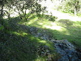
Beauty: 5
Duration: 2 days after a significant rainfall
Height 14 feet (broadly defined)
Height 11 feet
Biggest vertical drop 4 feet
Terrain: woods, little or no trail
unclear whether this is on public or private land
Last visited 2017-01-24
id: bigrock.171
Unnamed creek in the north-central part of Blackstone Canyon
- waterfall at (38.044191, -122.556003):
taken 2017-01-24:

Video:

Beauty: 5.5
Duration: 3 days after a significant rainfall
Height 31 feet
Biggest vertical drop 3 feet
Terrain: woods, little or no trail
Last visited 2017-01-24
id: bigrock.169
- waterfall at (38.044511, -122.556302):
taken 2017-01-24:


Video:
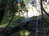
Beauty: 5
Duration: 3 days after a significant rainfall
Height 19 feet
Biggest vertical drop 3 feet
Terrain: woods, little or no trail
Last visited 2017-01-24
id: bigrock.170
Unnamed creek second largest creek in Blackstone Canyon, meeting the main creek near the trailhead
- waterfall at (38.044059, -122.557363):
taken 2017-01-24:

Video:
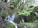
Beauty: 5
Duration: 4 days after a significant rainfall
Height 12 feet
Biggest vertical drop 2 feet
Terrain: woods, little or no trail
Last visited 2017-01-24
id: bigrock.168
Unnamed creek side creek in Blackstone Canyon 0.5 miles west of the trailhead on the north side
- waterfall at (38.040438, -122.558910):
taken 2017-01-24:

Video:
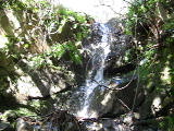
Beauty: 4
Duration: 3 days after a significant rainfall
Height 7 feet
Biggest vertical drop 1 feet
Terrain: woods, little or no trail
Last visited 2017-01-24
id: bigrock.165
Unnamed creek side creek in Blackstone Canyon 0.6 miles west of the trailhead on the north side
- waterfall just north of the main creek at (38.04011, -122.56107):
 taken 2017-01-24:

Video:
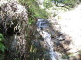
Beauty: 4.5
Duration: 3.5 days after a significant rainfall
Height 10 feet
Biggest vertical drop 2 feet
Terrain: unofficial trail, some difficulties
route: From the end of Valleystone Drive, follow the main canyon upstream 0.6 miles, and if you look carefully you should see it on the right
Last visited 2017-01-24
id: bigrock.2
- 50 yards upstream from the previous waterfall at (38.040361, -122.561003):
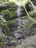 taken 2017-01-24:

Video:
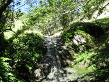
Beauty: 6
Duration: 3 days after a significant rainfall
Height 14 feet
Biggest vertical drop 2 feet
Terrain: vague hints of a trail
Last visited 2017-01-24
id: bigrock.3
Unnamed creek side creek in Blackstone Canyon 0.8 miles west of the trailhead on the north side
- waterfall at (38.0424890388, -122.5623688940):
taken 2017-01-24:

Video:
Beauty: 4
Duration: 3 days after a significant rainfall
Height 8 feet
Biggest vertical drop 2 feet
Terrain: woods, little or no trail
Last visited 2017-01-24
id: bigrock.167
Unnamed creek main creek in Blackstone Canyon
- I'm guessing this is the "third waterfall" described in Secret Waterfalls of Marin volume 1 at (38.04327, -122.56582):
taken 2018-04-08:
 taken 2010-02-28:
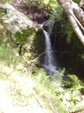
Video:
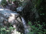
Beauty: 5
Duration: 10 days after a significant rainfall
Height 7 feet
Biggest vertical drop 5 feet
Terrain: unofficial trail, frequently used
For more info, see Secret Waterfalls of Marin volume 1
Last visited 2018-03-25
id: bigrock.7
- waterfall at (38.041768, -122.562883):
Poor gps reception - coordinates may be unreliable
taken 2017-01-24:


Videos:
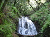
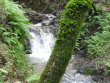
The gps coordinates look wrong, and should show something farther west.
Beauty: 6
Duration: 25 days after a significant rainfall
Height 11 feet (broadly defined)
Height 8 feet
Biggest vertical drop 6 feet
Terrain: unofficial trail, frequently used
Last visited 2017-01-24
id: bigrock.166
- waterfall at (38.045095, -122.568016):
taken 2018-04-08:

Video:
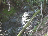
Beauty: 3.5
Duration: 4 days after a significant rainfall
Height 11 feet
Biggest vertical drop 2 feet
Terrain: woods, little or no trail
Last visited 2018-04-08
id: bigrock.176
- waterfall at (38.045111, -122.568169):
taken 2018-04-08:

Video:
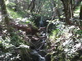
Beauty: 5
Duration: 4 days after a significant rainfall
Height 25 feet
Biggest vertical drop 4 feet
Terrain: woods, little or no trail
Last visited 2018-04-08
id: bigrock.177
Unnamed creek side creek in Blackstone Canyon 0.8 miles west of the trailhead on the south side, flowing more west to east than the other side creeks
Unnamed creek side creek in Blackstone Canyon 0.7 miles west of the trailhead on the south side
Unnamed creek flowing south from the west end of the Ponte Fire Rd
- waterfall at (38.045082, -122.566841):
taken 2018-03-25:

Beauty: 4.5
Duration: 2 days after a significant rainfall
Height 8 feet
Biggest vertical drop 1 feet
Terrain: woods, little or no trail
Last visited 2018-03-25
id: bigrock.173
- waterfall at (38.045528, -122.566339):
Beauty: 5
Duration: 2 days after a significant rainfall
Height 10 feet
Biggest vertical drop 2 feet
Terrain: woods, little or no trail
Last visited 2018-03-25
id: bigrock.174
- waterfall at (38.046133, -122.566303):
taken 2018-03-25:

Beauty: 5
Duration: 2 days after a significant rainfall
Height 9 feet
Biggest vertical drop 4 feet
Terrain: woods, little or no trail
Last visited 2018-03-25
id: bigrock.175
Unnamed creek about 0.1 miles east of Queenstone Drive
- waterfall by Queenstone Fire Rd at (38.03440, -122.54989):

Duration: 3 days after a significant rainfall
Height 8 feet
Biggest vertical drop 8 feet
Number of drops 1
Terrain: well-maintained fire road
route: follow the Queenstone Fire Rd up about 200 yards from Queenstone Drive and look uphill where the road makes a big right turn
id: bigrock.41
Unnamed creek descending to Queenstone Drive
- waterfall by Queenstone Fire Rd, at the Queenstone Drive trailhead: at (38.03440, -122.54989):
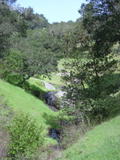
Duration: 5 days after a significant rainfall
Height 6 feet
Terrain: well-maintained fire road
id: bigrock.8
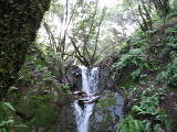
- waterfall at (38.03544, -122.55099):
taken 2010-12-22:
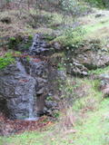
Beauty: 4
Beauty: 5 (including beauty of the hike to the falls)
Duration: 3 days after a significant rainfall
Height 12 feet (broadly defined)
Height 6 feet
Biggest vertical drop 4 feet
Terrain: moderate brush, little or no trail
route: From the north end of Queenstone Drive, follow the nearest stream uphill (northwest) until you've gained about 150 feet of elevation
Last visited 2010-12-22
id: bigrock.39
Unnamed creek descending to Queenstone Drive
- waterfall at (38.03389, -122.55204):
taken 2010-12-22:
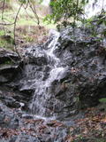
Beauty: 4
Beauty: 5 (including beauty of the hike to the falls)
Duration: 3 days after a significant rainfall
Height 8 feet
Terrain: moderate brush, little or no trail
route: From the north end of Queenstone Drive, head west (left and slightly uphill) about 350 feet
Last visited 2010-12-22
id: bigrock.38
Unnamed creek 0.1 mile west of Queenstone Drive
- waterfall at (38.03393, -122.55304):
taken 2010-12-22:
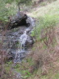
Beauty: 4
Beauty: 5 (including beauty of the hike to the falls)
Duration: 3 days after a significant rainfall
Height 6 feet
Biggest vertical drop 1 feet
Number of drops 3
Terrain: moderate brush, little or no trail
route: From the north end of Queenstone Drive, head west (left and slightly uphill) for about 600 feet
Last visited 2010-12-22
id: bigrock.36
- waterfall at (38.03341, -122.55229):
taken 2010-12-22:
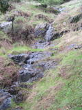
Beauty: 3
Beauty: 4 (including beauty of the hike to the falls)
Duration: 2 days after a significant rainfall
Height 12 feet (broadly defined)
Height 6 feet
Biggest vertical drop 2 feet
Number of drops 4
Terrain: moderate brush, little or no trail
route: From the north end of Queenstone Drive, traverse west for about 400 feet and follow the stream uphill a bit
Last visited 2010-12-22
id: bigrock.37
Unnamed creek north of Juniperberry Drive
- waterfall on a small stream just north of Juniperberry Rd: at (38.03235, -122.55473):
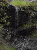 taken 2010-12-22:
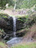
Beauty: 5
Beauty: 4 (including beauty of the hike to the falls)
Duration: 3 days after a significant rainfall
Height 12 feet (broadly defined)
Height 8 feet
Biggest vertical drop 6 feet
Number of drops 2
Terrain: moderate brush, little or no trail
route: From the trailhead at the north end of Juniperberry Drive, go west about 500 feet to the 2nd stream
id: bigrock.9
- Mostly a slide, with little vertical at (38.03335, -122.55518):
taken 2010-12-22:

It might be impressive with unusually heavy flow, but it's rarely more than a tricke
Beauty: 5
Beauty: 6 (including beauty of the hike to the falls)
Duration: 2 days after a significant rainfall
Height 60 feet (broadly defined)
Height 50 feet
Biggest vertical drop 2 feet
Number of drops 5
Terrain: moderate brush, little or no trail
route: From the trailhead at the north end of Juniperberry Drive, go west a short ways and head uphill about halfway to the ridge
Last visited 2010-12-22
id: bigrock.34
- waterfall at (38.03393, -122.55304):
taken 2010-12-22:

Beauty: 4
Beauty: 5 (including beauty of the hike to the falls)
Duration: 3 days after a significant rainfall
Height 6 feet
Biggest vertical drop 1 feet
Number of drops 3
Terrain: moderate brush, little or no trail
route: From the trailhead at the north end of Juniperberry Drive, go west about 100 feet and head uphill
Last visited 2010-12-22
id: bigrock.35
back to main waterfalls page


 taken 2017-01-24:

 taken 2017-01-24:


 taken 2010-02-28:


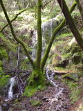 taken 2017-01-24:


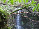
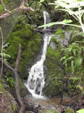 taken 2017-01-24:


 taken 2010-12-22:

