Waterfalls around Big Rock Ridge
The Big Rock Ridge / Marinwood area - 6 preserves from Lucas Valley east to route 101. Bored Feet sells a decent maps of this area from Tom Harrison and from Pease Press (northeast Marin county) which show maybe half the trails in the area.
Ignacio Valley Open Space Preserve
Unnamed creek
- waterfall at (38.055505, -122.577392):
taken 2019-02-20:

Video:
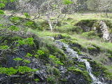
Beauty: 5
Duration: 6 days after a significant rainfall
Height 15 feet
Biggest vertical drop 8 feet
Terrain: woods, little or no trail
Last visited 2019-02-20
id: bigrock.186
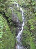
Unnamed creek ending near Pensacola Court
- waterfall at (38.05477, -122.57654):
taken 2019-02-20:
 taken 2012-03-20:
Video:

Beauty: 5
Duration: 60 days after a significant rainfall
Height 38 feet (broadly defined)
Height 30 feet
Biggest vertical drop 8 feet
Terrain: vague hints of a trail
route: You can get there by starting upstream from Piping Rock Drive and then following a bike trail southeast that ascends to an elevation of about 500 feet. Once you're on a flattish ridge, leave the trail and traverse east. You will intersect the creek near one of the upper falls. Or there's a frequently used trail going up the ridge just east of the falls (no public access at the bottom, somewhat faint path starting down from near the east end of the Big Rock Fire Rd). To find the falls from that trail, look carefully for an abandoned dirt road heading southwest from an elevation of a bit over 500 feet.
Last visited 2019-02-20
id: bigrock.29
- waterfall at (38.05487, -122.57672):
taken 2019-02-20:


Video:
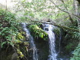
Beauty: 4.5
Duration: 60 days after a significant rainfall
Height 6 feet
Biggest vertical drop 4 feet
Number of drops 1
Terrain: woods, little or no trail
route: follow the creek downstream from the the uppermost falls
Last visited 2019-02-20
id: bigrock.30
- waterfall at (38.05537, -122.57691):
taken 2019-02-20:


Video:

Beauty: 5
Duration: 60 days after a significant rainfall
Height 25 feet
Biggest vertical drop 4 feet
Terrain: woods, little or no trail
route: follow the creek downstream from the the uppermost falls
Last visited 2019-02-20
id: bigrock.31
- waterfall at (38.05714, -122.57764):

Video:
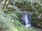
Beauty: 6.5
Duration: 60 days after a significant rainfall
Height 7 feet
Biggest vertical drop 3 feet
Number of drops 1
Terrain: woods, little or no trail
route: follow the creek downstream from the the uppermost falls
Last visited 2019-02-20
id: bigrock.32
- waterfall at (38.05714, -122.57764):
taken 2019-02-20:


Videos:


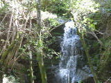
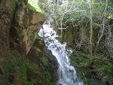
Beauty: 7.5
Duration: 60 days after a significant rainfall
Height 26 feet give or take 3 feet
Biggest vertical drop 8 feet
Terrain: woods, little or no trail
route: follow the creek downstream from the the uppermost falls
Last visited 2019-02-20
id: bigrock.33
- waterfall at (38.05508, -122.57672):
taken 2019-02-20:

Video:

Beauty: 5
Duration: 60 days after a significant rainfall
Height 9 feet
Biggest vertical drop 4 feet
Terrain: woods, little or no trail
route: follow the creek downstream from the the uppermost falls
Last visited 2019-02-20
id: bigrock.100
- waterfall at (38.050721, -122.578239):
taken 2019-02-20:


Video:

I photographed this while standing by remnants of the barbed wire fence that presumably marks the park boundary
Beauty: 4.5
Duration: 7 days after a significant rainfall
Height 13 feet
Biggest vertical drop 1 feet
Terrain: woods, little or no trail
on private land, readily visible from public land
route: There's a decent path which follows the valley up from near bigrock.29, missing this waterfall by about 100 yards because it goes by a different fork of the creek
Last visited 2019-02-20
id: bigrock.188
Unnamed creek east fork of creek heading toward Thunderbird Drive
- waterfall at (38.05250, -122.57248):
taken 2014-12-04:

Beauty: 3
Duration: 2 days after a significant rainfall
Height 10 feet
Biggest vertical drop 3 feet
Terrain: woods, little or no trail
Last visited 2014-12-04
id: bigrock.130
Unnamed creek heading to Wentworth Lane, middle fork
- waterfall at (38.05215, -122.56659):
taken 2014-12-04:

Beauty: 3
Duration: 5 days after a significant rainfall
Height 6 feet
Biggest vertical drop 3 feet
Terrain: woods, little or no trail
Last visited 2014-12-04
id: bigrock.122
- waterfall at (38.05217, -122.56682):
taken 2019-02-04:


Video:

Beauty: 4.5
Duration: 8 days after a significant rainfall
Height 8 feet
Biggest vertical drop 7 feet
Terrain: woods, little or no trail
Last visited 2019-02-04
id: bigrock.123
- waterfall at (38.05341, -122.56667):
taken 2014-12-04:


Video:

Beauty: 6
Duration: 8 days after a significant rainfall
Height 29 feet (broadly defined)
Height 19 feet
Biggest vertical drop 14 feet
Terrain: woods, little or no trail
Last visited 2014-12-04
id: bigrock.129
Unnamed creek heading to Wentworth Lane, east fork
- waterfall at (38.05326, -122.56465):
taken 2014-12-04:

Beauty: 3.5
Duration: 5 days after a significant rainfall
Height 10 feet (broadly defined)
Height 5 feet
Biggest vertical drop 5 feet
Terrain: woods, little or no trail
Last visited 2014-12-04
id: bigrock.124
- waterfall at (38.05369, -122.56500):
taken 2014-12-04:

Beauty: 4
Duration: 8 days after a significant rainfall
Height 10 feet
Biggest vertical drop 1 feet
Terrain: woods, little or no trail
Last visited 2014-12-04
id: bigrock.126
- waterfall at (38.05412, -122.56586):
taken 2014-12-04:

Video:
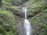
Beauty: 5
Duration: 8 days after a significant rainfall
Height 8 feet
Biggest vertical drop 3 feet
Terrain: woods, little or no trail
Last visited 2014-12-04
id: bigrock.127
- waterfall at (38.05431, -122.56620):
taken 2014-12-04:


Video:
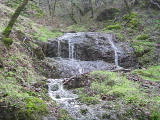
Beauty: 5
Duration: 8 days after a significant rainfall
Height 10 feet
Biggest vertical drop 3 feet
Number of drops 2
Terrain: woods, little or no trail
Last visited 2014-12-04
id: bigrock.128
Unnamed creek heading west from top of Halloween trail
- waterfall at (38.05349, -122.56455):
taken 2014-12-04:

Beauty: 4
Duration: 2 days after a significant rainfall
Height 7 feet
Terrain: woods, little or no trail
Last visited 2014-12-04
id: bigrock.125
back to main waterfalls page


 taken 2012-03-20:


