Waterfalls around Las Trampas
including adjacent EBMUD land
Las Trampas Regional Park
Unnamed creek flowing west into Devil's Hole
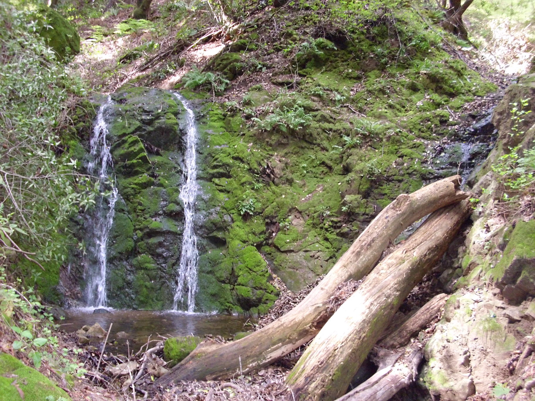
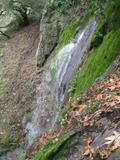
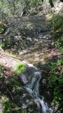
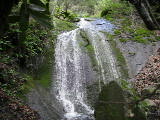
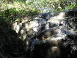
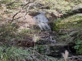
- waterfall at (37.79623, -122.05705):
taken 2014-04-02:

Video:
Beauty: 6
Duration: 4 days after a significant rainfall
Height 39 feet
Biggest vertical drop 1 feet
Terrain: woods, little or no trail
route: An easy walk upstream from the bottom of the Devil's Hole trail
Last visited 2014-04-02
id: trampas.10
West fork of Cull Creek(?)
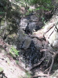
- waterfall at (37.80078, -122.05552):
taken 2012-12-22:
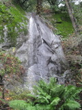
Videos:
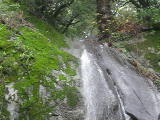
Beauty: 7.5
Duration: 21 days after a significant rainfall
Height 39 feet give or take 4 feet
Biggest vertical drop 35 feet
Number of drops 1
Terrain: steep slopes with rock outcroppings
route: I got there by heading downstream from the upper part of the Sycamore trail - it's not too hard to reach the top, but getting down to a good view is very steep. The terrain is a little easier if approached by following the creek up from the bottom of he Sycamore trail. There might be an easier approach from the west.
Last visited 2012-12-22
id: trampas.5
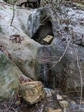
- waterfall at (37.801816, -122.054465):
gps coordinates estimated from map, reliability unknown
taken 2012-12-22:
Video:
Beauty: 5
Duration: 18 days after a significant rainfall
Height 29 feet
Number of drops 1
Terrain: woods, little or no trail
route: Head downstream from the upper part of the Sycamore trail
Last visited 2012-12-22
id: trampas.6
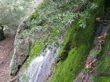
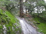
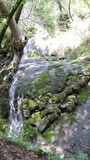
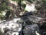
- waterfall at (37.79797, -122.05638):
taken 2014-04-02:
Video:
Beauty: 5
Duration: 21 days after a significant rainfall
Height 24 feet
Terrain: steep slopes with rock outcroppings
Last visited 2014-04-02
id: trampas.8
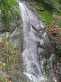
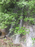
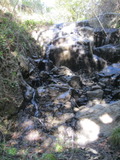
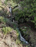
- waterfall at (37.79774, -122.05646):
taken 2014-04-02:
Videos:
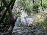
Beauty: 7
Duration: 25 days after a significant rainfall
Height 38 feet give or take 2 feet
Biggest vertical drop 8 feet
Terrain: steep slopes with rock outcroppings
Last visited 2014-04-02
id: trampas.9
- Waterfall 1/4 mile east of Eagle Peak at (37.824948, -122.042835):
Poor gps reception - coordinates may be unreliable

Beauty: 6.5
Duration: 45 days after a significant rainfall
Height 12 feet
Biggest vertical drop 10 feet
Terrain: unofficial trail, some difficulties
route: You can easily get almost in sight of it by following a meadow southwest along a ridge from where the Corduroy Hills trail switches from a fire road to a single track. But the last 100 feet to get a good view of the falls has some difficult terrain.
Last visited 2010-03-21
id: trampas.1
- A smaller waterfall a little farther east at (37.824711, -122.041204):
Poor gps reception - coordinates may be unreliable

Beauty: 2
Duration: 30 days after a significant rainfall
Height 6 feet
Terrain: unofficial trail, some difficulties
Last visited 2010-03-21
id: trampas.2
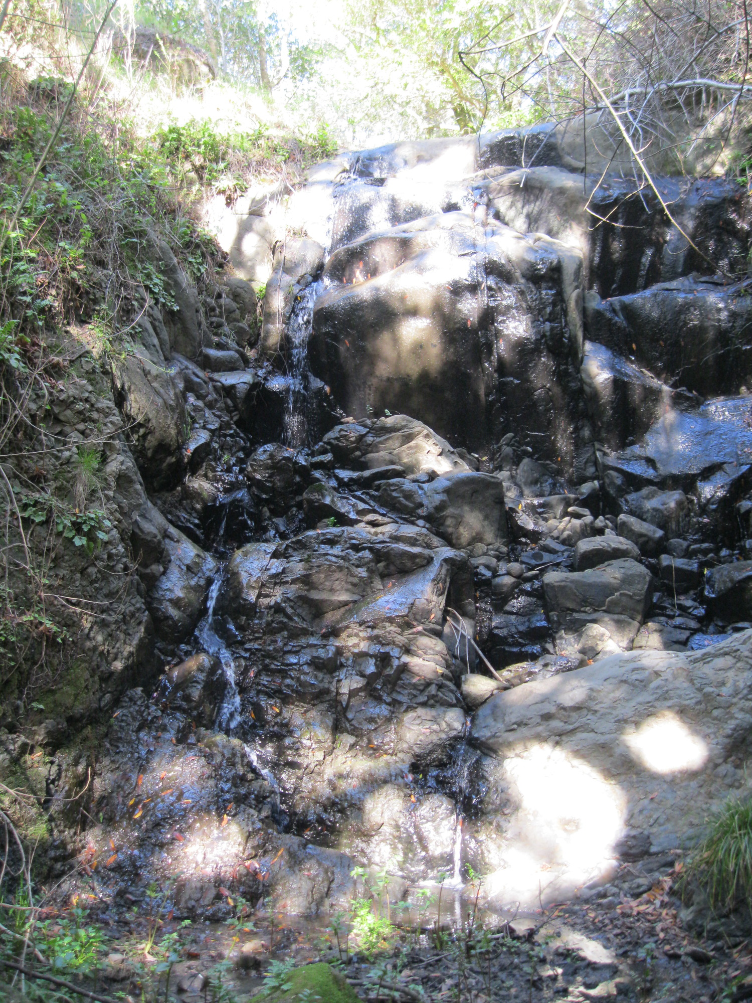
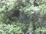
- waterfall at (37.812835, -122.046955):
gps coordinates estimated from map, reliability unknown
taken 2012-12-22:

a glimpse of an upper drop:
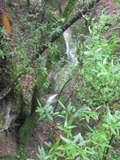
Video:
Partly visible from the lower end of the Elderberry trail
Beauty: 5.5
Duration: 10 days after a significant rainfall
Height 16 feet
Biggest vertical drop 4 feet
Number of drops 4
Terrain: well-maintained trail
Last visited 2012-12-22
id: trampas.7
EBMUD San Leandro Watershed
Unnamed creek flowing south then west from the antennas on the highest peak in Las Trampas
- waterfall at (37.80490, -122.06133):
taken 2012-02-22:
Video:
Beauty: 6
Duration: 60 days after a significant rainfall
Height 22 feet give or take 3 feet
Biggest vertical drop 5 feet
Terrain: woods, little or no trail
EBMUD land, permit required (buy here)
Last visited 2012-02-22
id: trampas.3
- waterfall at (37.80462, -122.06182):
taken 2012-02-22:
Video:
Beauty: 4
Duration: 60 days after a significant rainfall
Height 32 feet
Biggest vertical drop 6 feet
Number of drops 3
Terrain: woods, little or no trail
EBMUD land, permit required (buy here)
Last visited 2012-02-22
id: trampas.4
Unnamed creek flowing south then west from the antennas on the highest peak in Las Trampas
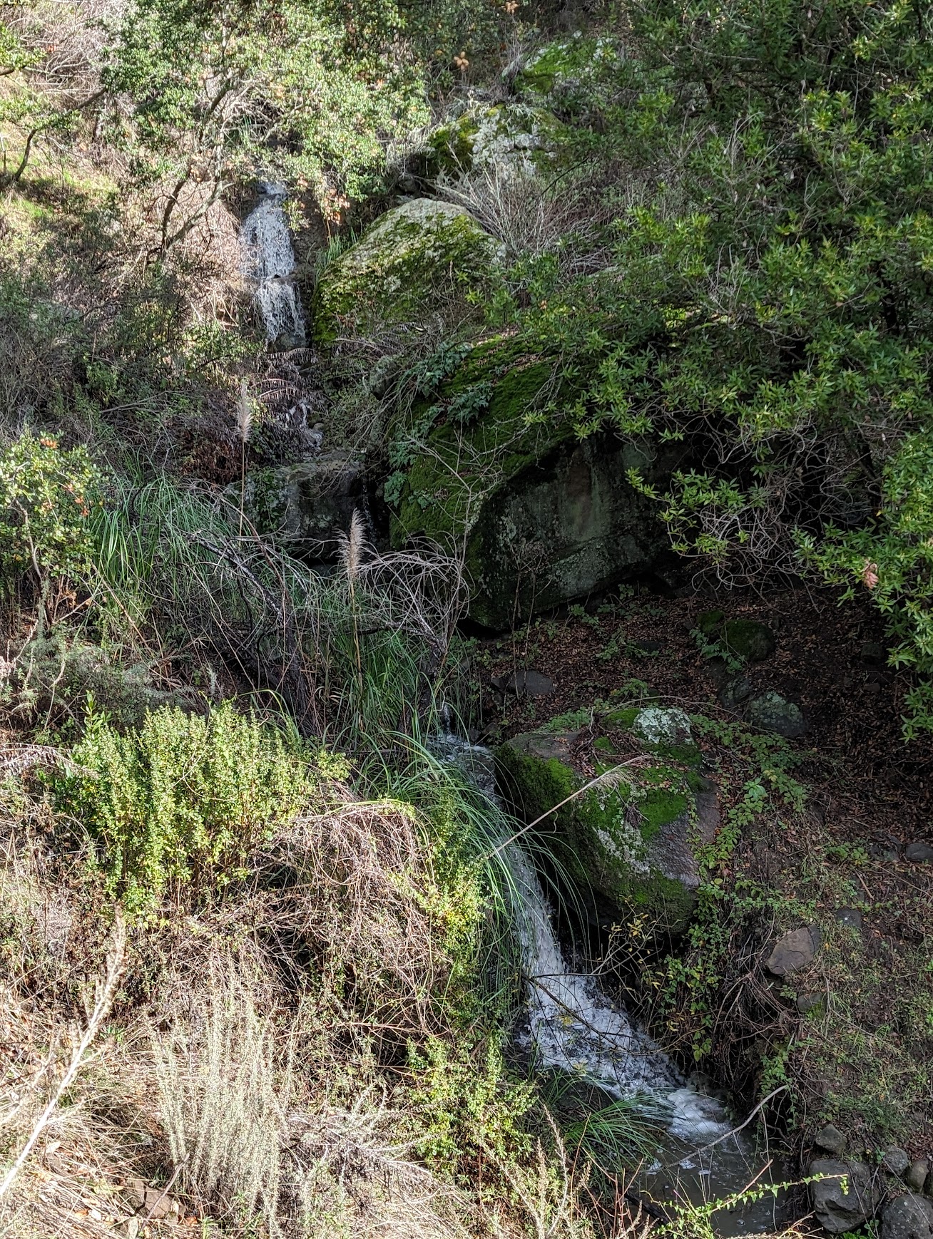
- waterfall at (37.810679, -122.069211):
taken 2024-01-14:
Video:
Beauty: 6
Duration: 14 days after a significant rainfall
Height 36 feet
Biggest vertical drop 8 feet
Number of drops 5
Terrain: woods, little or no trail
EBMUD land, permit required (buy here)
Last visited 2024-01-14
id: trampas.11
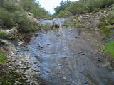
- waterfall at (37.799269, -122.125796):
taken 2024-01-14:
Beauty: 5.5
Duration: 2 days after a significant rainfall
Height 10 feet
Biggest vertical drop 4 feet
Number of drops 2
Terrain: well-maintained fire road
EBMUD land, permit required (buy here)
Last visited 2024-01-14
id: trampas.12
back to main waterfalls page