Waterfalls around Mt. Diablo
Mount Diablo State Park and parks connected to it. See Save Mount Diablo to buy a good map.
Only the best waterfalls in this region are listed on this page. See the complete list.
Mount Diablo State Park
Unnamed creek flowing southwest from Eagle Peak
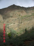
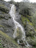
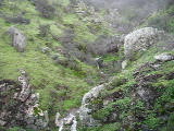
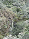
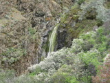
- Waterfall on the southwest side of Eagle Peak at (37.89935, -121.94031):
taken 2010-01-23:
 taken 2012-03-15:
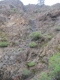
The first photo was taken from Mitchell Canyon Road. The second (completely dry) from close up. I recommend viewing it from the road only - I started several rockslides while getting closer. It doesn't have a well-defined bottom, so the height estimate is somewhat arbitrary.
Beauty: 7
Duration: 2 days after a significant rainfall
Height 184 feet
Number of drops 3
Terrain: steep slopes with rock outcroppings
Last visited 2012-03-15
id: diablo.1
Unnamed creek flowing north from just west of Prospectors Gap into Donner Canyon
- waterfall at (37.898063, -121.916296):
Name: Donner Creek Falls #5
gps coordinates estimated from map, reliability unknown
taken 2019-03-21:


Videos:
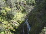
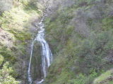
When it's flowing well, it's readily visible from the part of the Falls trail that's a quarter mile to the north. It is well hidden from the closer parts of the Falls trail.
This creek must come from a drainage area with deeper soil than the other Donner Canyon falls, because it starts flowing later in the season than neighboring creeks, and continues flowing later.
I must have seen this waterfall many times from the distance, but often confused it with Donner Creek Falls #4. Even after deciding it was a separate waterfall, I had trouble finding a closer view of it. I didn't get a good estimate of the height this time, due to a dead range-finder battery.
Beauty: 8.5
Duration: 40 days after a significant rainfall
Height 25 feet
Biggest vertical drop 12 feet
Terrain: moderate brush, little or no trail
route: I'm keeping my route secret, as I worry that it would get more traffic than the terrain can handle. I'll tell you what not to do: I once tried to follow the creek to look for waterfalls on it, but gave up without finding this due to the thick brush.
Last visited 2019-03-21
id: diablo.92
Unnamed creek flowing north from just north of Prospectors Gap into Donner Canyon
Unnamed creek flowing northwest from the intersection of North Peak Rd and the North Peak Trail
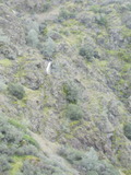
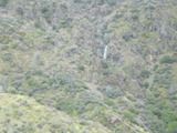
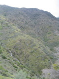
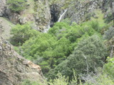
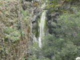
- waterfall at (37.89543, -121.90834):
taken 2011-03-20:

view from a ridge 1/4 mile north:
view from near Mt Olympia Rd:
view from near Mt Olympia Rd showing it above and to the right of Wild Oat Falls:
view of the quasi-waterfall just downstream (the waterfall is hiding in the cliff to the right of the visible part of the creek:

Video:
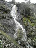
Beauty: 8.5
Duration: 7 days after a significant rainfall
Height 30 feet
Biggest vertical drop 6 feet
Terrain: cliffs
route: Please admire it from one of the ridges to the north. I reached the falls by crossing the creek above the falls and descending on the southwest side. Do NOT do that. If there's a route to it that's not unusually dangerous, it's likely to involve descending through some trees that show in the last photo directly above the part of the creek that is visible in that photo.
Last visited 2011-03-20
id: diablo.12
- waterfall at (37.89856, -121.91110):
Name: Donner Creek Falls #3
taken 2012-04-11:
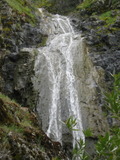

lower half:
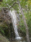
middle and upper parts:
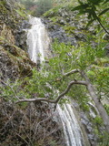
Videos:

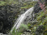
Beauty: 9
Duration: 20 days after a significant rainfall
Height 58 feet give or take 4 feet
Biggest vertical drop 20 feet
Number of drops 2
Terrain: unofficial trail, some difficulties
For more info, see:
http://www.waterfallswest.com/waterfall.php?id=208
route: Take the Falls Trail starting on the east side. This fall is just upstream of the second of two close stream crossings. There's a crude trail on the left side of the creek, hard to see because it starts out over steep bedrock. It is also possible (but not easy) to scramble up from the first stream crossing to a steep rocky ridge that provides a view of much of it.
Last visited 2012-04-11
id: diablo.15
Unnamed creek flowing from North Peak to the bottom of Wild Oat Canyon
- waterfall at (37.89691, -121.90813):
taken 2011-03-20:

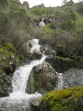
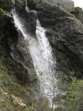
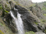
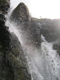
Videos:
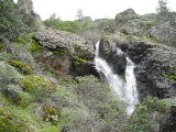
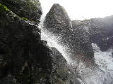
Beauty: 7.5
Duration: 10 days after a significant rainfall
Height 15 feet (broadly defined)
Height 13 feet
Biggest vertical drop 7 feet
Number of drops 1
Terrain: steep slopes with rock outcroppings
Last visited 2011-03-20
id: diablo.9
Wild Oat Canyon Creek flowing west from the saddle just south of Mt Olympia
- waterfall at (37.89905, -121.90810):
Name: Wild Oat Falls
taken 2016-03-15:

 taken 2011-03-20:

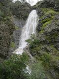
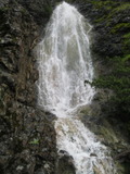

from the ridge just west of Mt Olympia Rd:
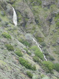
wider view from the same spot, with another 30 foot waterfall visible in the distance (higher and to the right):

Video:
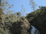
Can also be seen from Meridian Ridge Rd (more than a half mile to its west
Beauty: 9
Duration: 12 days after a significant rainfall
Height 53 feet give or take 5 feet
Biggest vertical drop 20 feet
Number of drops 1
Terrain: steep grassy slope
route: from where Mt Olympia Rd starts up a ridge that sticks out to the west of Mt Olympia, walk a short way west on the ridge, and if it's flowing enough to be worth getting closer you will easily spot it to your southeast. You can head roughly straight toward the bottom end of it.
Last visited 2016-03-15
id: diablo.8
Donner Creek
- waterfall at (37.89901, -121.91324):
Name: Donner Creek Falls #2
taken 2012-04-11:
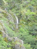
the upper fall:
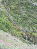
Mostly visible from the Falls Trail. A closer approach didn't appear to be worth the effort.
Beauty: 7
Duration: 30 days after a significant rainfall
Height 15 feet
Number of drops 1
Terrain: well-maintained trail
For more info, see:
http://www.waterfallswest.com/waterfall.php?id=208
Last visited 2012-04-11
id: diablo.16
- waterfall at (37.899375, -121.913847):
Name: Donner Creek Falls #1
gps coordinates estimated from map, reliability unknown
taken 2012-04-11:

the lower fall:

Video:
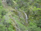
Visible from the Falls Trail. A closer approach didn't appear to be worth the effort.
Beauty: 7
Duration: 30 days after a significant rainfall
Height 15 feet
Terrain: well-maintained trail
For more info, see:
http://www.waterfallswest.com/waterfall.php?id=208
Last visited 2012-04-11
id: diablo.17
Unnamed creek west fork of Dunn Creek?
- waterfall at (37.905014, -121.892235):
taken 2015-02-09:


 taken 2017-02-10:

Videos:

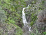

Visible from a flat area along Quarry Road, just south of Wise Rd
Beauty: 7
Duration: 9 days after a significant rainfall
Height 32 feet give or take 3 feet
Biggest vertical drop 10 feet
Terrain: well-maintained fire road
Last visited 2015-02-09
id: diablo.25
Dunn Creek
- waterfall at (37.904209, -121.890577):
taken 2015-02-09:
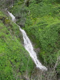

Video:

Beauty: 7
Duration: 14 days after a significant rainfall
Height 31 feet
Biggest vertical drop 3 feet
Terrain: steep slopes with rock outcroppings
route: approach from upstream
Last visited 2015-02-09
id: diablo.28
- waterfall at (37.903831, -121.890585):
lower parts taken 2015-02-09:


upper section:


Videos:
Visible from Three Springs Road, and from Wise Road (just downhill from the intersection with the Quicksilver trail)
Beauty: 8.5
Duration: 14 days after a significant rainfall
Height 68 feet
Biggest vertical drop 8 feet
Terrain: moderate brush, little or no trail
route: Take the Ridgeline trail (just west of Rhyne Mine) to its top. At the sign which says end of trail, turn right. Follow remnants of a road that goes west for about 0.2 mile. After I lost track of the road at a stream, I continued traversing on deer trails to the next stream, then headed northwest over the next ridge. Descending from that ridge to the waterfall was a bit hard, and I probably haven't find the best route yet.
Last visited 2015-02-09
id: diablo.29
Unnamed creek flowing southeast to cross the east end of Rhine Canyon Rd
- waterfall at (37.878214, -121.904368):
taken 2016-01-30:


Video:
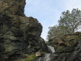
Beauty: 7
Duration: 2 days after a significant rainfall
Height 28 feet
Biggest vertical drop 12 feet
Terrain: moderate brush, little or no trail
Last visited 2016-01-30
id: diablo.51
Unnamed creek in Rhine Canyon
- waterfall at (37.876930, -121.908560):
taken 2016-01-30:


Videos:
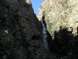
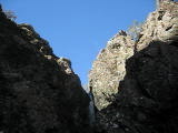
Hiding in a narrow chasm. My height estimate excludes the easier to see lower drop.
Beauty: 8
Duration: 25 days after a significant rainfall
Height 26 feet
Biggest vertical drop 12 feet
Terrain: cliffs
route: The only semi-safe route I found was to approach from downstream on the east side of the creek. The best view is from in the creek about 100 feet downstream. I also viewed it under dry conditions from a small rock ridge a few feet east of the creek, but that was too hard to reach with wet soil.
Last visited 2016-01-30
id: diablo.42
- waterfall at (37.874707, -121.907011):
taken 2016-01-30:


upper drops:

upper half:

Videos:


Beauty: 8.5
Duration: 28 days after a significant rainfall
Height 52 feet
Number of drops 3
Terrain: moderate brush, little or no trail
route: about 0.1 mile upstream from Rhine Canyon Rd; best reached via a slight ridge on west side of creek
Last visited 2016-01-30
id: diablo.48
Sycamore Creek
- waterfall at (37.83691, -121.91850):
Name: Sycamore Creek Falls
taken 2011-03-10:
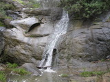
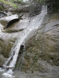
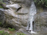
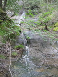
A well maintained fire road passes quite close to it, and if you look carefully you can see where the top of the waterfall is from the fire road, but be careful choosing your route down to where you can get a view. If you start down near the falls, it's very steep. Farther downstream is flatter but beware of poison oak and blackberries. I'm surprised that there's virtually no path to a nice waterfall within shouting distance of a residential area.
Beauty: 7.5
Duration: 40 days after a significant rainfall
Height 22 feet (broadly defined)
Height 17 feet
Biggest vertical drop 2 feet
Number of drops 2
Terrain: woods, little or no trail
route: Follow Sycamore Creek Rd down to where it ends at private property, then go back upstream until the road is about 25 feet higher than the creek. Look for a safe route down to the creek and follow it upstream. There are several ways to reach Sycamore Creek Rd: from Rock City down the Trail Through Time, from Curry Point via Knobcone Pt Rd and Devil's Slide Trail, or go up Black Sage Rd (starting in the parking lot of a soccer field on Black Hawk Rd) and turn right just before the fire road ends [Update - as of Feb 2016 Black Sage Rd has a locked gate that would be hard to go over or around].
Last visited 2011-03-10
id: diablo.4
West Branch Alamo Creek
- waterfall at (37.839024, -121.896091):
taken 2017-01-09:


smaller stream:

Videos:
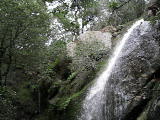
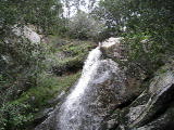
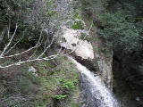
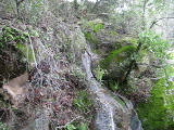
Two separate streams forming waterfalls side by side. The smaller one shows on the left in the first video, and is the focus of the last video. The upper half of this waterfall can be seen from the upper part of Black Hills Rd.
Beauty: 7.5
Duration: 7 days after a significant rainfall
Height 25 feet
Biggest vertical drop 8 feet
Terrain: woods, little or no trail
route: Go to the end of the utility access road (the one starting at the west end of the Oyster Point trail), turn right and head directly toward the side stream. Follow the side stream down to a deer trail that allows you to see most of the waterfall. Be wary of trying for a better view. The poison oak is thick below the deer trail.
Last visited 2017-01-09
id: diablo.55
Unnamed creek flowing south across the Amphitheater trail
- waterfall at (37.838665, -121.859116):
taken 2019-03-29:

Video:

Beauty: 7
Duration: 5 days after a significant rainfall
Height 29 feet
Biggest vertical drop 5 feet
Terrain: unofficial trail, some difficulties
route: There's a faint path going up from Old Finley Road, about 100 feet west of the creek.
Last visited 2019-03-29
id: diablo.93
- waterfall at (37.846762, -121.935879):
taken 2023-01-16:

Video:

At a distance of possibly 190 yards, my range finder is inaccurate enough that the height estimate is little more than a guess. I doubt there's any realistic way to get a closer view. The gps coordinates are taken from above the waterfall - it's easy to see roughly where the waterfall is from just above it, but no way to get from there to a view of it.
Beauty: 7
Duration: 2 days after a significant rainfall
Height 40 feet
Biggest vertical drop 8 feet
Terrain: dense bushes
route: from the bottom of the Summit trail, go off trail above South Gate Road until you see where the creek goes under the road, and further walking becomes very difficult due to dense brush. A possibly easier route (that I have not done) starts from Rock City and follows a path underneath power lines.
Last visited 2023-01-16
id: diablo.102
Diablo Foothills Regional Park
Unnamed creek in Little Yosemite Valley
- waterfall at (37.876599, -121.984624):
taken 2017-02-03:


Videos:
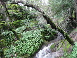
It's a bit tricky to find the right time to visit this, but it's worth it. The photos I show were taken less than a day after a half inch of rain. The ground was pretty saturated before the rain, but the mud on the trails had been drying for about 10 days. With more rain than that, I'd have had to choose between deep mud on the trails from the south, or unpleasant creek crossings on Stage Rd. With much less rain, it wouldn't have enough water to be impressive.
Beauty: 8
Duration: 14 days after a significant rainfall
Height 26 feet (broadly defined)
Height 22 feet
Biggest vertical drop 1 feet
Terrain: well-maintained trail
Last visited 2017-02-03
id: diablo.40
back to main waterfalls page
 taken 2012-03-15:




 taken 2011-03-20:


 taken 2017-02-10:


