Waterfalls around Big Rock Ridge
The Big Rock Ridge / Marinwood area - 6 preserves from Lucas Valley east to route 101. Bored Feet sells a decent maps of this area from Tom Harrison and from Pease Press (northeast Marin county) which show maybe half the trails in the area.
Lucas Valley Open Space Preserve
Unnamed creek heading south toward Rubicon Creek
- waterfall at (38.04522, -122.58343):
taken 2017-01-20:


Video:
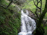
Beauty: 5.5
Duration: 7 days after a significant rainfall
Height 14 feet
Biggest vertical drop 3 feet
Number of drops 2
Terrain: woods, little or no trail
Last visited 2017-01-20
id: bigrock.118
- waterfall at (38.04492, -122.58316):
taken 2017-01-20:

Video:
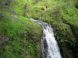
Beauty: 5
Duration: 7 days after a significant rainfall
Height 11 feet
Terrain: woods, little or no trail
Last visited 2017-01-29
id: bigrock.119
- waterfall at (38.04473, -122.58279):
taken 2017-01-20:


Videos:
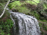
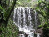
Beauty: 7
Duration: 7 days after a significant rainfall
Height 14 feet
Biggest vertical drop 14 feet
Terrain: woods, little or no trail
Last visited 2017-01-20
id: bigrock.120
- waterfall at (38.04356, -122.58250):
taken 2017-01-20:


Video:
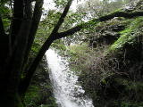
Beauty: 7
Duration: 10 days after a significant rainfall
Height 29 feet
Biggest vertical drop 8 feet
Terrain: woods, little or no trail
route: Best reached from downstream, on the west side of the creek. It's steep upstream from here.
Last visited 2017-01-20
id: bigrock.121
- waterfall at (38.046448, -122.583381):
taken 2014-12-13:

Video:
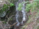
Beauty: 3.5
Duration: 2 days after a significant rainfall
Height 24 feet
Biggest vertical drop 3 feet
Terrain: woods, little or no trail
Last visited 2014-12-13
id: bigrock.142
- waterfall at (38.043379, -122.582573):
taken 2017-01-20:

Video:
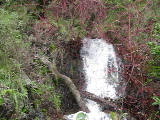
Beauty: 5
Duration: 10 days after a significant rainfall
Height 18 feet
Biggest vertical drop 3 feet
Terrain: woods, little or no trail
Last visited 2017-01-20
id: bigrock.147
- waterfall at (38.045986, -122.583398):
taken 2017-01-20:


Video:
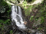
two creeks join right at the top of this waterfall
Beauty: 4.5
Duration: 3 days after a significant rainfall
Height 7 feet
Biggest vertical drop 3 feet
Terrain: woods, little or no trail
Last visited 2017-01-20
id: bigrock.148
- waterfall at (38.046375, -122.583362):
taken 2017-01-20:

upper half:

Video:
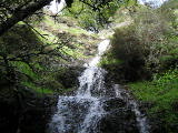
Beauty: 5.5
Duration: 2 days after a significant rainfall
Height 15 feet
Biggest vertical drop 3 feet
Terrain: woods, little or no trail
Last visited 2017-01-20
id: bigrock.149
Unnamed creek heading south, starting slightly east of the top of Luiz Fire Rd
- waterfall at (38.046811, -122.583738):
taken 2017-01-20:

Video:
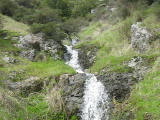
Beauty: 4
Duration: 2 days after a significant rainfall
Height 15 feet (broadly defined)
Height 6 feet
Biggest vertical drop 2 feet
Terrain: woods, little or no trail
Last visited 2017-01-20
id: bigrock.150
Unnamed creek heading south from the top of Luiz Fire Rd
- waterfall at (38.046689, -122.584337):
bottom taken 2017-01-20:

middle and upper parts:

bottom:

bottom and middle:

near the bottom:

bottom:

Videos:
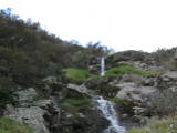

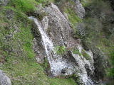
Beauty: 5.5
Duration: 3 days after a significant rainfall
Height 42 feet
Biggest vertical drop 5 feet
Terrain: moderate brush, little or no trail
Last visited 2017-01-20
id: bigrock.151
- waterfall at (38.047772, -122.584971):
taken 2017-01-20:

Video:
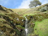
Beauty: 5
Duration: 2 days after a significant rainfall
Height 10 feet
Biggest vertical drop 5 feet
Terrain: fields, no trail
Last visited 2017-01-20
id: bigrock.153
Unnamed creek heading southeast toward Rubicon Creek
- waterfall at (38.04239, -122.58354):
taken 2014-04-04:

Video:
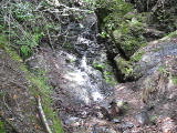
Beauty: 4
Duration: 7 days after a significant rainfall
Height 11 feet
Biggest vertical drop 1 feet
Terrain: woods, little or no trail
Last visited 2014-04-04
id: bigrock.117
- waterfall at (38.046953, -122.585953):
taken 2017-01-20:

middle:

Videos:
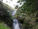
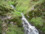
Beauty: 5.5
Duration: 4 days after a significant rainfall
Height 28 feet
Biggest vertical drop 5 feet
Terrain: woods, little or no trail
route: traverse from the road on top of Big Rock Ridge
Last visited 2017-01-20
id: bigrock.152
- waterfall at (38.045300, -122.585609):
taken 2017-02-18:


upper half:

Videos:
Beauty: 7.5
Duration: 5 days after a significant rainfall
Height 37 feet
Biggest vertical drop 8 feet
Terrain: woods, little or no trail
Last visited 2017-02-18
id: bigrock.157
- waterfall at (38.045320, -122.585578):
taken 2017-02-18:

Video:
Beauty: 4.5
Duration: 5 days after a significant rainfall
Height 10 feet
Biggest vertical drop 2 feet
Terrain: woods, little or no trail
Last visited 2017-02-18
id: bigrock.158
Unnamed creek flowing east, from near the top of the Luiz Fire Rd
- waterfall at (38.045949, -122.586429):
the top is hard to see taken 2017-02-18:

Video:
Beauty: 4
Duration: 2 days after a significant rainfall
Height 32 feet
Biggest vertical drop 6 feet
Terrain: woods, little or no trail
Last visited 2017-02-18
id: bigrock.159
Unnamed creek flowing south, a bit east of the lower half of the Luiz Fire Rd
- waterfall at (38.039761, -122.589098):
taken 2017-02-18:

 taken 2019-03-03:

Videos:
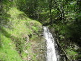

Beauty: 7.5
Duration: 6 days after a significant rainfall
Height 24 feet
Biggest vertical drop 12 feet
Terrain: woods, little or no trail
Last visited 2019-03-03
id: bigrock.154
- waterfall at (38.040137, -122.588881):
taken 2017-02-18:


Video:
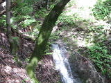
Beauty: 5
Duration: 5 days after a significant rainfall
Height 12 feet
Biggest vertical drop 2 feet
Terrain: woods, little or no trail
Last visited 2017-02-18
id: bigrock.155
- waterfall at (38.040542, -122.588944):
taken 2017-02-18:

upper half:

Video:
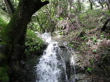
Beauty: 5.5
Duration: 4 days after a significant rainfall
Height 30 feet
Biggest vertical drop 5 feet
Terrain: woods, little or no trail
Last visited 2017-02-18
id: bigrock.156
Unnamed creek flowing south, just west of the lower half of the Luiz Fire Rd
- waterfall at (38.043043, -122.592701):
taken 2017-02-18:

Video:
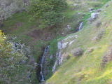
Beauty: 4.5
Duration: 2 days after a significant rainfall
Height 14 feet
Biggest vertical drop 2 feet
Terrain: fields, no trail
Last visited 2017-02-18
id: bigrock.164
Unnamed creek flowing west from near the top of the Luiz Fire Rd
- waterfall at (38.04678, -122.59032):
all but the upper part taken 2011-02-26:
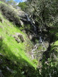
upper part:
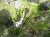
lower part:
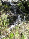
Beauty: 7
Duration: 16 days after a significant rainfall
Height 20 feet (broadly defined)
Height 10 feet
Biggest vertical drop 2 feet
Number of drops 4
Terrain: woods, little or no trail
Last visited 2011-02-26
id: bigrock.70
Unnamed creek flowing west, from a bit northwest of the top of the Luiz Fire Rd
- waterfall at (38.050326, -122.591199):
taken 2017-02-18:

Video:
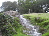
Beauty: 4.5
Duration: 2 days after a significant rainfall
Height 20 feet (broadly defined)
Height 15 feet
Biggest vertical drop 1 feet
Terrain: fields, no trail
Last visited 2017-02-18
id: bigrock.160
- waterfall at (38.050299, -122.592038):
taken 2017-02-18:


Video:

Beauty: 5.5
Duration: 2.5 days after a significant rainfall
Height 18 feet
Biggest vertical drop 2 feet
Terrain: fields, no trail
Last visited 2017-02-18
id: bigrock.161
- waterfall at (38.050299, -122.592236):
taken 2017-02-18:


Video:
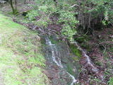
Beauty: 5.5
Duration: 2.5 days after a significant rainfall
Height 18 feet
Biggest vertical drop 1 feet
Terrain: woods, little or no trail
Last visited 2017-02-18
id: bigrock.162
Unnamed creek the main creek between the Luiz Fire Rd and the Grady Fire Rd
- waterfall at (38.04470, -122.59724):
lower part taken 2011-02-26:
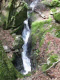
the main cascades going around the rock, small parts flowing over the rock:
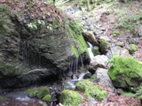
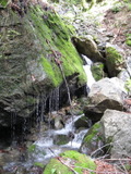
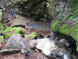
upper cascades:

Beauty: 6
Duration: 45 days after a significant rainfall
Height 38 feet (broadly defined)
Height 10 feet
Biggest vertical drop 6 feet
Number of drops 5
Terrain: woods, little or no trail
Last visited 2011-02-26
id: bigrock.71
- waterfall at (38.04691, -122.59437):
taken 2011-02-26:
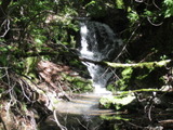
Beauty: 4
Duration: 45 days after a significant rainfall
Height 8 feet
Biggest vertical drop 4 feet
Terrain: woods, little or no trail
Last visited 2011-02-26
id: bigrock.72
- waterfall at (38.052623, -122.593538):
taken 2017-02-18:

Video:
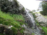
appears to be a few feet outside of the preserve, judging from the barbed wire
Beauty: 4.5
Duration: 1.5 days after a significant rainfall
Height 15 feet
Biggest vertical drop 4 feet
Terrain: woods, little or no trail
on private land, readily visible from public land
Last visited 2017-02-18
id: bigrock.163
Unnamed creek flowing south, a bit east of the Grady Fire Rd
- waterfall at (38.046299, -122.595664):
taken 2016-03-23:

Beauty: 4.5
Duration: 4 days after a significant rainfall
Height 13 feet
Biggest vertical drop 1 feet
Terrain: woods, little or no trail
Last visited 2016-03-23
id: bigrock.145
- waterfall at (38.046169, -122.595661):
taken 2016-03-23:

Beauty: 5
Duration: 4 days after a significant rainfall
Height 18 feet
Biggest vertical drop 4 feet
Terrain: woods, little or no trail
Last visited 2016-03-23
id: bigrock.146
Unnamed creek west of Grady Fire Rd
- waterfall at (38.04917, -122.60197):
taken 2019-03-03:


Videos:

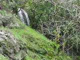
The 2nd video shows the next falls near the top of this one
Beauty: 7.5
Duration: 14 days after a significant rainfall
Height 21 feet
Biggest vertical drop 12 feet
Terrain: woods, little or no trail
Last visited 2019-03-03
id: bigrock.101
- waterfall at (38.04939, -122.60182):
taken 2019-03-03:
 taken 2012-03-21:

Videos:


Beauty: 7.5
Duration: 14 days after a significant rainfall
Height 18 feet
Biggest vertical drop 17 feet
Terrain: woods, little or no trail
Last visited 2019-03-03
id: bigrock.102
- waterfall at (38.04957, -122.60150):
taken 2012-03-21:

Beauty: 3.5
Duration: 14 days after a significant rainfall
Height 8 feet
Terrain: woods, little or no trail
Last visited 2011-03-21
id: bigrock.103
- waterfall at (38.04973, -122.59968):
taken 2012-03-21:

Video:
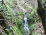
Beauty: 5
Duration: 14 days after a significant rainfall
Height 17 feet
Terrain: woods, little or no trail
Last visited 2011-03-21
id: bigrock.104
- waterfall at (38.05009, -122.59879):
taken 2012-03-21:

Video:
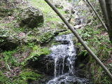
Beauty: 4
Duration: 14 days after a significant rainfall
Height 18 feet
Terrain: woods, little or no trail
Last visited 2011-03-21
id: bigrock.105
- waterfall at (38.05117, -122.59839):
taken 2012-03-21:

Video:
Beauty: 3
Duration: 12 days after a significant rainfall
Height 12 feet
Terrain: woods, little or no trail
Last visited 2011-03-21
id: bigrock.106
- waterfall at (38.05196, -122.59735):
taken 2012-03-21:

Beauty: 2
Duration: 10 days after a significant rainfall
Height 8 feet
Terrain: woods, little or no trail
Last visited 2011-03-21
id: bigrock.107
Unnamed creek southeast of the summit, heading southwest
- waterfall at (38.05173, -122.60313):
taken 2014-03-06:


Video:
Beauty: 4
Duration: 14 days after a significant rainfall
Height 30 feet
Terrain: woods, little or no trail
Last visited 2014-03-06
id: bigrock.110
Unnamed creek southeast of the summit, heading southwest
- waterfall at (38.05487, -122.60237):
taken 2014-03-06:

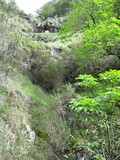

Video:
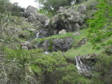
It's debatable whether this should be considered one or three waterfalls
Beauty: 5
Duration: 14 days after a significant rainfall
Height 69 feet
Biggest vertical drop 5 feet
Number of drops 3
Terrain: woods, little or no trail
Last visited 2014-03-06
id: bigrock.111
Unnamed creek south of the Big Rock summit
- waterfall at (38.04905, -122.60487):
taken 2011-03-16:
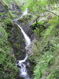
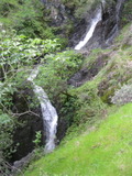
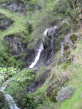
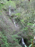 taken 2019-03-03:

the upper drop (barely visible in any of the other photos), seen from a few feet away from the top of the largest drop taken 2011-03-16:
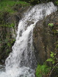
Videos:
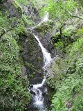
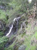
It's hard to see the whole falls from any one point.
Beauty: 9
Duration: 30 days after a significant rainfall
Height 75 feet give or take 10 feet
Biggest vertical drop 20 feet
Number of drops 3
Terrain: woods, little or no trail
route: From the just east of the Big Rock Ridge Summit, follow the large ridge that goes south-southwest a half mile. Before it reaches a level section with a few trees on the ridgetop, traverse east 0.1 mile and follow a smaller ridge down about 0.2 mile. Follow a deer track to the creek on the east side of this ridge.
Last visited 2019-03-03
id: bigrock.77
- waterfall at (38.05184, -122.60472):
taken 2011-03-16:

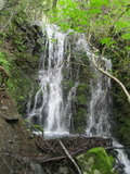
looking down from the top:

Beauty: 7.5
Duration: 28 days after a significant rainfall
Height 20 feet (broadly defined)
Height 12 feet
Biggest vertical drop 10 feet
Terrain: woods, little or no trail
Last visited 2011-03-16
id: bigrock.92
- waterfall at (38.05261, -122.60412):
taken 2014-03-06:


Video:
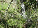
Beauty: 4.5
Duration: 14 days after a significant rainfall
Height 19 feet
Biggest vertical drop 3 feet
Number of drops 2
Terrain: woods, little or no trail
Last visited 2014-03-06
id: bigrock.112
Unnamed creek
- waterfall at (38.05106, -122.60766):
taken 2011-03-16:
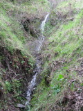
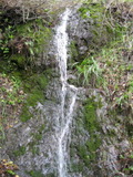
Beauty: 4.5
Duration: 5 days after a significant rainfall
Height 12 feet
Biggest vertical drop 1 feet
Terrain: woods, little or no trail
Last visited 2011-03-16
id: bigrock.91
Unnamed creek
- waterfall at (38.04640, -122.60816):
taken 2011-03-16:
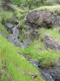

the lower part:
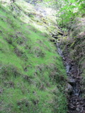
upper parts:
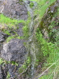

Beauty: 6
Duration: 3 days after a significant rainfall
Height 60 feet (broadly defined)
Height 45 feet
Biggest vertical drop 2 feet
Terrain: woods, little or no trail
Last visited 2011-03-16
id: bigrock.90
Unnamed creek
- waterfall at (38.04561, -122.61021):
taken 2011-03-16:
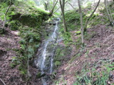
Beauty: 5.5
Duration: 3 days after a significant rainfall
Height 20 feet (broadly defined)
Height 18 feet
Biggest vertical drop 1 feet
Terrain: woods, little or no trail
Last visited 2011-03-16
id: bigrock.89
Unnamed creek
- waterfall at (38.04622, -122.61192):
lower part taken 2011-03-16:
upper part:
Beauty: 3.5
Duration: 3 days after a significant rainfall
Height 30 feet (broadly defined)
Height 15 feet
Biggest vertical drop 1 feet
Number of drops 2
Terrain: woods, little or no trail
Last visited 2011-03-16
id: bigrock.88
Unnamed creek
- waterfall at (38.04631, -122.61218):
lower part taken 2011-03-16:
upper part:

Beauty: 2
Duration: 2 days after a significant rainfall
Height 28 feet (broadly defined)
Height 10 feet
Biggest vertical drop 7 feet
Number of drops 2
Terrain: woods, little or no trail
Last visited 2011-03-16
id: bigrock.87
Unnamed creek starting 3/4 mile east of Big Rock near a mudslide, flowing west-northwest
- waterfall at (38.04931, -122.61286):
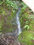
Beauty: 3
Beauty: 4 (including beauty of the hike to the falls)
Duration: 4 days after a significant rainfall
Height 6 feet
Biggest vertical drop 3 feet
Number of drops 2
Terrain: woods, little or no trail
Last visited 2011-02-22
id: bigrock.42
- waterfall at (38.04899, -122.61194):
taken 2011-03-16:
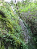
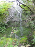
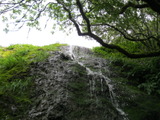

lower drops:
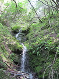 taken 2011-02-22:

view from top:

view from top:

rock outcrop that helps find the falls if you're reaching it from above; trailhead with the Big Rock in the distance:
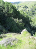
Videos:
the main drop is 30 feet high
Beauty: 7
Duration: 3 days after a significant rainfall
Height 63 feet (broadly defined)
Height 30 feet
Biggest vertical drop 3 feet
Number of drops 4
Terrain: fields, no trail
route: a simple but exhausting route is to go to the Big Rock Ridge summit and follow the largest ridge southwest from it (that would be on the left as you fast southwest from the top). After passing a part of the ridge that has ups and downs and a few trees on the ridge, you will reach a steep descent with a conspicuous mudslide. Head right (west) just above the mudslide, and descend on a small partly grassy ridge somewhat near the stream that flows down from the mudslide until you find a rock outcrop close to the stream
Last visited 2011-03-16
id: bigrock.43
- waterfall at (38.04893, -122.61145):
Beauty: 3
Duration: 3 days after a significant rainfall
Height 5 feet
Biggest vertical drop 3 feet
Number of drops 1
Terrain: moderate brush, little or no trail
Last visited 2011-02-22
id: bigrock.44
Unnamed creek starting on the south side of the Big Rock Ridge summit, flowing southwest
- waterfall at (38.05327, -122.61112):
taken 2011-02-22:

upper drop, taken from top of lower drop:
close enough to falls where streams converge that it could be classified as part of that waterfall
Beauty: 5
Beauty: 6 (including beauty of the hike to the falls)
Duration: 20 days after a significant rainfall
Height 14 feet
Biggest vertical drop 7 feet
Number of drops 2
Terrain: woods, little or no trail
Last visited 2011-02-22
id: bigrock.50
- waterfall at (38.05360, -122.61074):
taken 2011-02-22:
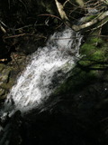
Beauty: 3
Beauty: 4 (including beauty of the hike to the falls)
Duration: 20 days after a significant rainfall
Height 8 feet (broadly defined)
Height 6 feet
Biggest vertical drop 1 feet
Number of drops 1
Terrain: woods, little or no trail
Last visited 2011-02-22
id: bigrock.51
- waterfall at (38.05389, -122.60944):
taken 2011-02-22:

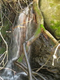
hiding in bushes next to a big rock outcrop
Beauty: 3
Beauty: 4 (including beauty of the hike to the falls)
Duration: 20 days after a significant rainfall
Height 8 feet (broadly defined)
Height 7 feet
Biggest vertical drop 7 feet
Number of drops 1
Terrain: woods, little or no trail
Last visited 2011-02-22
id: bigrock.52
- waterfall at (38.05389, -122.60944):
taken 2011-02-22:
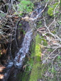
just upstream from a big rock outcrop
Beauty: 1
Beauty: 2 (including beauty of the hike to the falls)
Duration: 20 days after a significant rainfall
Height 8 feet (broadly defined)
Height 5 feet
Biggest vertical drop 1 feet
Terrain: woods, little or no trail
Last visited 2011-02-22
id: bigrock.53
- waterfall at (38.05440, -122.60922):
taken 2011-02-22:
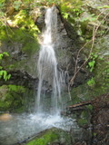
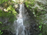
Beauty: 6
Beauty: 7 (including beauty of the hike to the falls)
Duration: 18 days after a significant rainfall
Height 9 feet
Biggest vertical drop 5 feet
Number of drops 2
Terrain: woods, little or no trail
Last visited 2011-02-22
id: bigrock.54
- waterfall at (38.05422, -122.60922):
taken 2011-03-14:
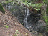
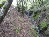
Beauty: 5
Duration: 18 days after a significant rainfall
Height 12 feet (broadly defined)
Height 10 feet
Biggest vertical drop 10 feet
Number of drops 1
Terrain: woods, little or no trail
Last visited 2011-03-14
id: bigrock.80
- waterfall at (38.05452, -122.60851):
taken 2011-03-14:
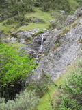
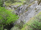
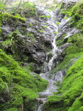
Beauty: 6
Duration: 18 days after a significant rainfall
Height 18 feet (broadly defined)
Height 14 feet
Biggest vertical drop 3 feet
Terrain: woods, little or no trail
Last visited 2011-03-14
id: bigrock.81
- waterfall at (38.05516, -122.60812):
taken 2011-03-14:
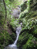
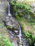
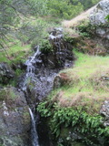

Beauty: 6.5
Duration: 16 days after a significant rainfall
Height 22 feet (broadly defined)
Height 20 feet
Biggest vertical drop 4 feet
Number of drops 4
Terrain: woods, little or no trail
Last visited 2011-03-14
id: bigrock.82
- waterfall at (38.05578, -122.60715):
taken 2011-03-14:
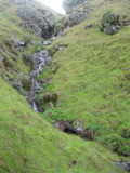
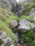

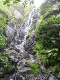
Beauty: 4.5
Duration: 10 days after a significant rainfall
Height 25 feet (broadly defined)
Height 11 feet
Biggest vertical drop 5 feet
Terrain: fields, no trail
Last visited 2011-03-14
id: bigrock.83
- waterfall at (38.05608, -122.60655):
taken 2011-03-14:
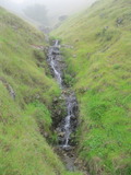
Beauty: 4
Duration: 7 days after a significant rainfall
Height 10 feet (broadly defined)
Height 7 feet
Biggest vertical drop 2 feet
Terrain: fields, no trail
Last visited 2011-03-14
id: bigrock.84
Unnamed creek starting halfway down the largest ridge on the south side of the Big Rock Ridge summit
- waterfall at (38.05067, -122.61104):
taken 2011-02-22:
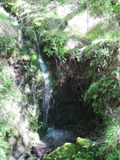
Beauty: 6.5
Beauty: 7 (including beauty of the hike to the falls)
Duration: 6 days after a significant rainfall
Height 9 feet
Biggest vertical drop 4 feet
Number of drops 1
Terrain: woods, little or no trail
Last visited 2011-02-22
id: bigrock.45
- waterfall at (38.05087, -122.60988):
taken 2011-02-22:
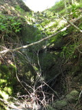
Beauty: 3
Duration: 4 days after a significant rainfall
Height 12 feet (broadly defined)
Height 6 feet
Biggest vertical drop 4 feet
Number of drops 1
Terrain: woods, little or no trail
Last visited 2011-02-22
id: bigrock.46
Unnamed creek starting on the southwest side of the Big Rock Ridge summit, flowing southwest
- waterfall at (38.05100, -122.61131):
Poor gps reception - coordinates may be unreliable
taken 2011-02-22:
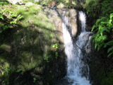
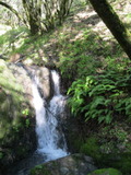
Beauty: 4
Duration: 20 days after a significant rainfall
Height 6 feet
Biggest vertical drop 2 feet
Number of drops 1
Terrain: woods, little or no trail
Last visited 2011-02-22
id: bigrock.47
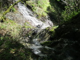
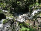
- The top half of this waterfall consists of two independent creeks, which merge halfway down the waterfall at (38.05327, -122.61112):
taken 2011-03-14:
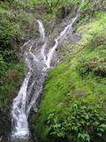
the west fork, and part of the lower section taken 2011-02-22:
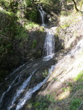
the east fork, and much of the lower section:

the east fork, seen from the top of the west fork:

the upper half, seen from the top of the west fork:
the upper half, seen from the top of the west fork:

the upper half, seen from the top of the west fork:
the west fork, the top of the east fork visible at the bottom:

looking down from the top of the east fork:
Videos:
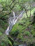
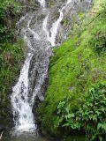
each creek flowing into this waterfall has another waterfall near enough to this that I'm using the same gps coordinates for all three. On the Tom Harrison map of Big Rock Ridge (2007), it's at L in Lucas Valley Preserve.
Beauty: 9
Beauty: 8 (including beauty of the hike to the falls)
Duration: 20 days after a significant rainfall
Height 37 feet give or take 3 feet
Biggest vertical drop 12 feet
Terrain: woods, little or no trail
route: From the Big Rock trailhead, follow the Big Rock trail 1.0 mile. When it passes under a few small oaks shortly after the switchback, head straight uphill. When you reach a ridge (in the middle of another group of oaks), find a deer track that traverses east just above the bushes. You should pass above a medium sized rock outcrop. Cross the creek on a deer trail at the top of a 10 foot waterfall that is somewhat hidden in bushes. The terrain is somewhat difficult here, but most other parts of the creek have steeper terrain with bushes. Traverse to the southeast until you reach the next ridge. Look for a field with some small rocks at the upper end. Head straight downhill through that field, and find a deer track at which to cross the creek. Follow the creek a short ways downhill and the waterfall will stop you.
Last visited 2011-02-22
id: bigrock.48
- waterfall at (38.05327, -122.61112):
taken 2011-02-22:
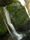
Just a few feet above the falls where streams converge. I normally classify waterfalls this close as one, but this one is hidden so that it's hard to see while looking at the main waterfall, and the presence of two creeks complicates the classification
Beauty: 5
Beauty: 6 (including beauty of the hike to the falls)
Duration: 20 days after a significant rainfall
Height 8 feet (broadly defined)
Height 6 feet
Biggest vertical drop 2 feet
Number of drops 2
Terrain: woods, little or no trail
Last visited 2011-02-22
id: bigrock.49
Unnamed creek
- waterfall at (38.05441, -122.60983):
lower part taken 2011-03-14:
upper part:

It would take a very heavy rain for this to be worth visiting.
Beauty: 2
Duration: 1 days after a significant rainfall
Height 27 feet
Biggest vertical drop 6 feet
Number of drops 2
Terrain: woods, little or no trail
Last visited 2011-03-14
id: bigrock.79
Unnamed creek heading southwest from the summit
- waterfall at (38.05569, -122.61060):
taken 2014-03-06:


Video:
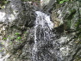
Beauty: 6
Duration: 14 days after a significant rainfall
Height 18 feet
Biggest vertical drop 16 feet
Number of drops 1
Terrain: woods, little or no trail
Last visited 2014-03-06
id: bigrock.113
- waterfall at (38.05618, -122.61026):
taken 2014-03-06:

Video:
Beauty: 4
Duration: 14 days after a significant rainfall
Height 16 feet
Biggest vertical drop 9 feet
Terrain: woods, little or no trail
Last visited 2014-03-06
id: bigrock.114
- waterfall at (38.05617, -122.60978):
taken 2014-03-06:

Video:
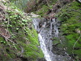
Beauty: 4
Duration: 12 days after a significant rainfall
Height 15 feet
Biggest vertical drop 2 feet
Terrain: woods, little or no trail
Last visited 2014-03-06
id: bigrock.115
- waterfall at (38.05764, -122.60805):
taken 2014-03-06:

Video:
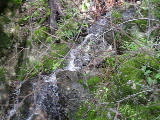
Beauty: 3
Duration: 10 days after a significant rainfall
Height 11 feet
Biggest vertical drop 3 feet
Terrain: woods, little or no trail
Last visited 2014-03-06
id: bigrock.116
Unnamed creek starting 1/4 mile west of the Big Rock Ridge summit, flowing south-southwest
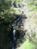
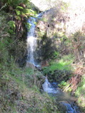
- waterfall at (38.05322, -122.61394):
taken 2011-02-22:
upper half:

Beauty: 6
Duration: 21 days after a significant rainfall
Height 28 feet (broadly defined)
Height 20 feet
Biggest vertical drop 6 feet
Number of drops 2
Terrain: moderate brush, little or no trail
Last visited 2011-02-22
id: bigrock.55
- waterfall at (38.05363, -122.61360):
taken 2011-02-22:

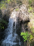
Beauty: 4
Duration: 21 days after a significant rainfall
Height 8 feet
Biggest vertical drop 5 feet
Number of drops 1
Terrain: moderate brush, little or no trail
Last visited 2011-02-22
id: bigrock.56
- waterfall at (38.054, -122.6134):
gps coordinates estimated from map, reliability unknown
from above taken 2011-02-22:
from above:
Beauty: 4
Duration: 21 days after a significant rainfall
Height 8 feet
Biggest vertical drop 6 feet
Number of drops 1
Terrain: moderate brush, little or no trail
Last visited 2011-02-22
id: bigrock.57
- waterfall at (38.05442, -122.61316):
taken 2011-02-22:
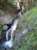
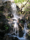


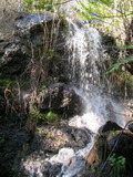
Beauty: 6
Duration: 21 days after a significant rainfall
Height 22 feet (broadly defined)
Height 15 feet
Biggest vertical drop 10 feet
Number of drops 3
Terrain: moderate brush, little or no trail
Last visited 2011-02-22
id: bigrock.58
- waterfall at (38.05459, -122.61317):
taken 2011-02-22:
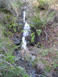

upper part:

seen from 1/4 mile south - the lower falls visible in the lower half of the photo:
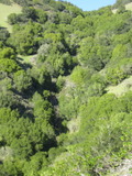
Beauty: 4
Beauty: 5 (including beauty of the hike to the falls)
Duration: 21 days after a significant rainfall
Height 24 feet
Biggest vertical drop 5 feet
Terrain: moderate brush, little or no trail
Last visited 2011-02-22
id: bigrock.59
- waterfall at (38.05486, -122.61307):
taken 2011-02-22:
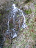
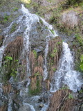
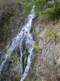
seen from 1/4 mile south - the upper falls visible in the lower half of the photo:

Beauty: 7
Duration: 21 days after a significant rainfall
Height 30 feet (broadly defined)
Height 25 feet
Biggest vertical drop 6 feet
Terrain: moderate brush, little or no trail
Last visited 2011-02-22
id: bigrock.60
- waterfall at (38.05590, -122.61257):
taken 2011-03-14:
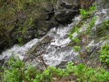

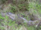
Beauty: 3.5
Duration: 20 days after a significant rainfall
Height 11 feet
Biggest vertical drop 2 feet
Terrain: moderate brush, little or no trail
Last visited 2011-03-14
id: bigrock.78
- waterfall at (38.05520, -122.61301):
upper part taken 2011-03-14:
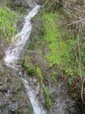
lower part:
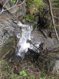
Beauty: 4
Duration: 18 days after a significant rainfall
Height 11 feet
Biggest vertical drop 2 feet
Number of drops 2
Terrain: woods, little or no trail
Last visited 2011-03-14
id: bigrock.85
- waterfall at (38.05677, -122.61215):
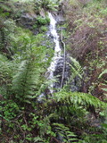
main part taken 2011-03-14:
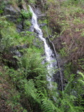
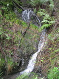
lower part:
most of it:
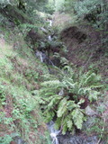
Very steep terrain
Beauty: 6
Duration: 16 days after a significant rainfall
Height 35 feet (broadly defined)
Height 18 feet
Biggest vertical drop 2 feet
Terrain: woods, little or no trail
Last visited 2011-03-14
id: bigrock.86
back to main waterfalls page


 taken 2019-03-03:


 taken 2012-03-21:


 taken 2019-03-03:


 taken 2011-02-22:


