Waterfalls around Big Rock Ridge
The Big Rock Ridge / Marinwood area - 6 preserves from Lucas Valley east to route 101. Bored Feet sells a decent maps of this area from Tom Harrison and from Pease Press (northeast Marin county) which show maybe half the trails in the area.
Lucas Valley Homeowners Association
Unnamed creek about 0.1 miles east of Mt Lassen Drive
- waterfall near Mt. Lassen Drive at (38.03057, -122.56788):
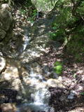
Duration: 7 days after a significant rainfall
Height 12 feet (broadly defined)
Height 10 feet
Terrain: unofficial trail, some difficulties
route: There appears to be a trailhead on Mt Dana Ct (off of Mt Lassen Drive. Go east 0.1 mile from there. After crossing a creek follow a faint trail upstream 100 feet. It's right where you enter some woods.
id: bigrock.10
Unnamed creek northeast of Pikes Peak Drive
- waterfall northeast of Mt. Shasta Drive: at (38.03441, -122.57237):
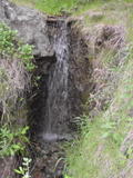
Duration: 3 days after a significant rainfall
Height 6 feet
Biggest vertical drop 6 feet
Number of drops 1
Terrain: moderate brush, little or no trail
route: From the north end of Pikes Peak Drive, follow a trail north 200 feet, then follow the creek on your right northeast for 300 feet. It will be at a fork in the creek, on the right.
id: bigrock.11
Unnamed creek northeast of Pikes Peak Drive
Unnamed creek 0.2 mile northeast of Rubicon Drive, flowing nearly due west
- waterfall at (38.03850, -122.58030):
gps coordinates estimated from map, reliability unknown
taken 2010-12-22:
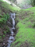
Beauty: 5
Beauty: 6 (including beauty of the hike to the falls)
Duration: 5 days after a significant rainfall
Height 9 feet
Biggest vertical drop 3 feet
Terrain: vague hints of a trail
route: From the north end of Rubicon Drive, follow the main stream up. A few hundred feet after the end of the ranch on the left, find the second side stream in the large flat area on the right. Follow it up a few hundred feet
Last visited 2010-12-22
id: bigrock.40
Unnamed creek starting 0.5 mile east of Rubicon Falls
- waterfall at (38.04039, -122.57527):
lower drop taken 2011-02-26:

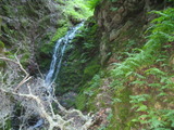
looking down:
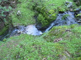
main drop:
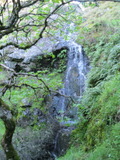
main drop:
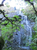
upper part:

the main drop is at least 10 feet
Beauty: 7
Duration: 10 days after a significant rainfall
Height 55 feet (broadly defined)
Height 30 feet
Biggest vertical drop 5 feet
Terrain: woods, little or no trail
Last visited 2011-02-26
id: bigrock.61
- waterfall at (38.04046, -122.57495):
taken 2011-02-26:

Beauty: 5
Duration: 10 days after a significant rainfall
Height 8 feet (broadly defined)
Height 7 feet
Biggest vertical drop 1 feet
Terrain: woods, little or no trail
Last visited 2011-02-26
id: bigrock.62
- waterfall at (38.04044, -122.57957):
taken 2011-02-26:
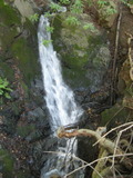
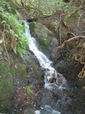
seen through a hammock:
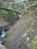

Beauty: 4
Beauty: 5 (including beauty of the hike to the falls)
Duration: 14 days after a significant rainfall
Height 10 feet (broadly defined)
Height 6 feet
Biggest vertical drop 1 feet
Terrain: vague hints of a trail
Last visited 2011-02-26
id: bigrock.65
- waterfall at (38.04058, -122.58019):
taken 2011-02-26:
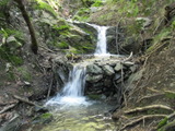
Beauty: 3
Beauty: 5 (including beauty of the hike to the falls)
Duration: 14 days after a significant rainfall
Height 7 feet (broadly defined)
Height 6 feet
Biggest vertical drop 3 feet
Number of drops 2
Terrain: vague hints of a trail
Last visited 2011-02-26
id: bigrock.66
Unnamed creek about 0.4 miles east of Rubicon Falls
- waterfall at (38.04087, -122.57618):
taken 2011-02-26:
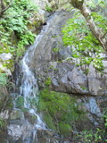
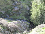
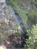


view from near an abandoned fire road 0.1 miles south taken ?:
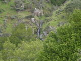
Beauty: 6
Duration: 5 days after a significant rainfall
Height 35 feet (broadly defined)
Height 10 feet
Biggest vertical drop 10 feet
Terrain: woods, little or no trail
id: bigrock.15
- waterfall at (38.04084, -122.57543):
taken 2011-02-26:

Beauty: 4
Duration: 4 days after a significant rainfall
Height 11 feet (broadly defined)
Height 10 feet
Biggest vertical drop 1 feet
Terrain: woods, little or no trail
Last visited 2011-02-26
id: bigrock.63
- waterfall at (38.04104, -122.57552):
taken 2011-02-26:
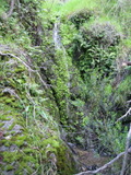
Beauty: 5
Duration: 3 days after a significant rainfall
Height 7 feet
Terrain: woods, little or no trail
Last visited 2011-02-26
id: bigrock.64
Unnamed creek
- waterfall at (38.04414, -122.574742):
taken 2014-12-13:

Video:
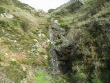
Beauty: 3.5
Duration: 2 days after a significant rainfall
Height 21 feet
Biggest vertical drop 2 feet
Terrain: vague hints of a trail
Last visited 2014-12-13
id: bigrock.135
- waterfall at (38.043796, -122.575212):
taken 2014-12-13:

Video:
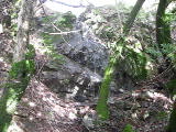
Beauty: 3.5
Duration: 2 days after a significant rainfall
Height 15 feet
Biggest vertical drop 7 feet
Terrain: woods, little or no trail
Last visited 2014-12-13
id: bigrock.136
- waterfall at (38.042478, -122.576121):
taken 2014-12-13:

Video:
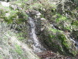
Beauty: 3.5
Duration: 3 days after a significant rainfall
Height 6 feet
Biggest vertical drop 4 feet
Terrain: woods, little or no trail
Last visited 2014-12-13
id: bigrock.137
- waterfall at (38.042478, -122.576121):
taken 2014-12-13:

Video:

Beauty: 4
Duration: 4 days after a significant rainfall
Height 28 feet (broadly defined)
Height 24 feet
Biggest vertical drop 5 feet
Terrain: woods, little or no trail
Last visited 2014-12-13
id: bigrock.138
- waterfall at (38.042044, -122.576664):
taken 2014-12-13:

Video:
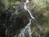
Beauty: 4.5
Duration: 5 days after a significant rainfall
Height 22 feet
Biggest vertical drop 2 feet
Terrain: woods, little or no trail
Last visited 2014-12-13
id: bigrock.139
- waterfall at (38.041782, -122.576871):
taken 2014-12-13:


Video:
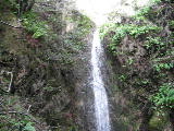
Beauty: 7
Duration: 6 days after a significant rainfall
Height 22 feet give or take 2 feet
Biggest vertical drop 10 feet
Terrain: woods, little or no trail
Last visited 2014-12-13
id: bigrock.140
- waterfall at (38.04094, -122.57795):
taken 2014-12-13:

Video:
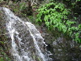
Beauty: 4
Duration: 6 days after a significant rainfall
Height 7 feet
Biggest vertical drop 5 feet
Terrain: woods, little or no trail
Last visited 2014-12-13
id: bigrock.141
Unnamed creek crossing Goat Trail about 0.4 miles below ridge
- waterfall on a lower part of the Goat Trail: at (38.04256, -122.57889):
taken 2017-01-20:

Video:
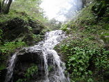
Beauty: 4
Beauty: 5 (including beauty of the hike to the falls)
Duration: 4 days after a significant rainfall
Height 6 feet
Biggest vertical drop 5 feet
Terrain: well-maintained trail
Last visited 2017-01-20
id: bigrock.17
- waterfall at (38.04200, -122.58070):
taken 2011-02-26:
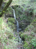
Beauty: 6
Duration: 7 days after a significant rainfall
Height 15 feet (broadly defined)
Height 13 feet
Biggest vertical drop 3 feet
Number of drops 2
Terrain: woods, little or no trail
Last visited 2011-02-26
id: bigrock.69
- waterfall at (38.04261, -122.57876):
Beauty: 4
Duration: 4 days after a significant rainfall
Height 6 feet
Biggest vertical drop 6 feet
Terrain: woods, little or no trail
Last visited 2011-10-11
id: bigrock.94
- waterfall at (38.04321, -122.57802):
Beauty: 3.5
Duration: 4 days after a significant rainfall
Height 12 feet (broadly defined)
Height 8 feet
Biggest vertical drop 1 feet
Terrain: woods, little or no trail
Last visited 2011-10-11
id: bigrock.95
- waterfall at (38.04337, -122.57781):
Beauty: 4
Duration: 4 days after a significant rainfall
Height 14 feet
Terrain: woods, little or no trail
Last visited 2011-10-11
id: bigrock.96
- waterfall at (38.04345, -122.57729):
Beauty: 5
Duration: 4 days after a significant rainfall
Height 15 feet (broadly defined)
Height 10 feet
Biggest vertical drop 6 feet
Terrain: woods, little or no trail
Last visited 2011-10-11
id: bigrock.97
Unnamed creek crossing Goat Trail about 0.2 miles below ridge
- waterfall hiding behind some chain ferns on the Goat Trail: at (38.04486, -122.57760):
taken 2017-01-20:

Video:
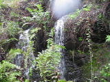
Beauty: 1
Beauty: 4 (including beauty of the hike to the falls)
Duration: 4 days after a significant rainfall
Height 8 feet
Terrain: well-maintained trail
Last visited 2017-01-20
id: bigrock.16
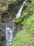
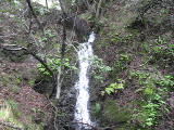
- waterfall at (38.04335, -122.58033):
taken 2014-12-13:
 taken 2011-02-26:
Video:
Beauty: 5
Duration: 14 days after a significant rainfall
Height 20 feet (broadly defined)
Height 17 feet
Biggest vertical drop 1 feet
Number of drops 2
Terrain: woods, little or no trail
Last visited 2014-12-13
id: bigrock.68
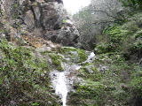
- waterfall at (38.04315, -122.57994):
main falls taken 2014-12-13:

lower parts:

Video:
Beauty: 4.5
Duration: 12 days after a significant rainfall
Height 68 feet (broadly defined)
Height 39 feet
Biggest vertical drop 2 feet
Terrain: woods, little or no trail
Last visited 2014-12-13
id: bigrock.93
- waterfall at (38.04374, -122.578967):
taken 2014-12-13:

Video:

Beauty: 6
Duration: 10 days after a significant rainfall
Height 13 feet
Biggest vertical drop 6 feet
Terrain: woods, little or no trail
Last visited 2014-12-13
id: bigrock.143
Unnamed creek
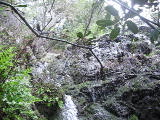
- waterfall at (38.044821, -122.579653):
taken 2014-12-13:

Video:
Beauty: 4.5
Duration: 6 days after a significant rainfall
Height 24 feet (broadly defined)
Height 18 feet
Biggest vertical drop 4 feet
Terrain: woods, little or no trail
Last visited 2014-12-13
id: bigrock.134
Unnamed creek
- waterfall at (38.044994, -122.579707):
taken 2014-12-13:

Video:

Beauty: 4
Duration: 2 days after a significant rainfall
Height 13 feet
Biggest vertical drop 1 feet
Terrain: woods, little or no trail
Last visited 2014-12-13
id: bigrock.133
Rubicon Creek
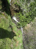
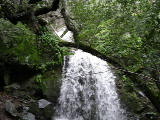
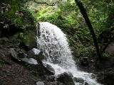
- waterfall at (38.04215, -122.58186):
Name: Rubicon Falls
taken 2017-01-20:

 taken 2014-12-13:


cascades at the top taken 2011-02-26:
Videos:

Beauty: 7
Duration: 20 days after a significant rainfall
Height 20 feet (broadly defined)
Height 13 feet
Biggest vertical drop 6 feet
Terrain: unofficial trail, frequently used
For more info, see Secret Waterfalls of Marin volume 1
Last visited 2017-01-20
id: bigrock.67
- waterfall at (38.04502, -122.580274):
taken 2014-12-13:

Beauty: 3
Duration: 4 days after a significant rainfall
Height 8 feet (broadly defined)
Height 5 feet
Biggest vertical drop 4 feet
Terrain: woods, little or no trail
Last visited 2014-12-13
id: bigrock.131
- waterfall at (38.045306, -122.579735):
taken 2014-12-13:

Video:

Beauty: 5
Duration: 4 days after a significant rainfall
Height 23 feet
Biggest vertical drop 2 feet
Terrain: woods, little or no trail
Last visited 2014-12-13
id: bigrock.132
back to main waterfalls page


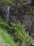


 taken 2011-02-26:


 taken 2014-12-13:


