Waterfalls around Big Rock Ridge
The Big Rock Ridge / Marinwood area - 6 preserves from Lucas Valley east to route 101. Bored Feet sells a decent maps of this area from Tom Harrison and from Pease Press (northeast Marin county) which show maybe half the trails in the area.
Pacheco Valle Preserve
Pacheco Creek
Little Pacheco Creek
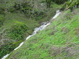
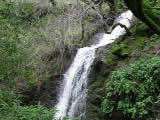
- waterfall at (38.05099, -122.55620):
taken 2019-02-04:


Videos:

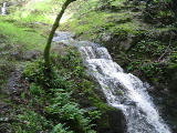
Beauty: 5.5
Duration: 10 days after a significant rainfall
Height 15 feet
Biggest vertical drop 3 feet
Terrain: unofficial trail, some difficulties
For more info, see Secret Waterfalls of Marin volume 2
route: From the end of Pacheco Creek Drive, follow the trail along the main creek a short way, take a right where the creek forks, and stay left along that smaller creek for a few hundred yards
Last visited 2019-02-04
id: bigrock.21
Unnamed creek small side creek on north side of Little Pacheco Creek
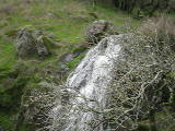
- waterfall at (38.05121, -122.55662):
taken 2019-02-04:

Beauty: 3
Duration: 1 days after a significant rainfall
Height 20 feet
Terrain: vague hints of a trail
Last visited 2019-02-04
id: bigrock.22
Little Pacheco Creek
- waterfall at (38.05103, -122.55760):
taken 2019-02-04:


Video:
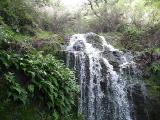
Beauty: 5.5
Duration: 10 days after a significant rainfall
Height 31 feet (broadly defined)
Height 10 feet
Biggest vertical drop 6 feet
Number of drops 1
Terrain: vague hints of a trail
route: From the end of Pacheco Creek Drive, follow the trail along the main creek a short way, take a right where the creek forks, and stay left along that smaller creek for 0.2 miles
Last visited 2019-02-04
id: bigrock.23
- waterfall at (38.05153, -122.55837):
taken 2019-01-17:

Video:

Beauty: 5
Duration: 4 days after a significant rainfall
Height 10 feet
Biggest vertical drop 2 feet
Terrain: vague hints of a trail
route: From the end of Pacheco Creek Drive, follow the trail along the main creek a short way, take a right where the creek forks, and stay left along that smaller creek for 0.25 miles
Last visited 2019-01-17
id: bigrock.24
- waterfall at (38.05193, -122.55868):
taken 2019-01-17:

Video:

Beauty: 5.5
Duration: 4 days after a significant rainfall
Height 66 feet
Biggest vertical drop 10 feet
Terrain: vague hints of a trail
route: From the end of Pacheco Creek Drive, follow the trail along the main creek a short way, take a right where the creek forks, and stay left along that smaller creek for 0.3 miles
Last visited 2019-01-17
id: bigrock.25
- waterfall at (38.051941, -122.558893):
taken 2019-01-17:


Video:
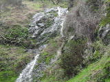
Beauty: 5
Duration: 3 days after a significant rainfall
Height 44 feet
Biggest vertical drop 5 feet
Terrain: moderate brush, little or no trail
Last visited 2019-01-17
id: bigrock.26
Unnamed creek The northernmost fork of Pacheco Creek (of those upstream from the paved road)
- waterfall at (38.052486, -122.554594):
taken 2019-02-04:

Video:

Beauty: 5.5
Duration: 5 days after a significant rainfall
Height 13 feet
Biggest vertical drop 5 feet
Terrain: woods, little or no trail
route: From the end of Pacheco Creek Drive, follow the trail along the main creek a short way, take a right where the creek forks, and stay right at the next fork.
Last visited 2019-02-04
id: bigrock.27
Unnamed creek just east of Little Cat Fire Rd
- waterfall at (38.053218, -122.546578):
taken 2016-01-17:

Video:
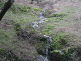
Beauty: 5.5
Duration: 2 days after a significant rainfall
Height 34 feet (broadly defined)
Height 14 feet
Biggest vertical drop 1 feet
Terrain: vague hints of a trail
Last visited 2016-01-17
id: bigrock.144
Unnamed creek flowing south into the upper part of Little Pacheco Creek
- waterfall at (38.052123, -122.558238):
taken 2019-01-17:

Video:

Beauty: 5.5
Duration: 4 days after a significant rainfall
Height 24 feet
Biggest vertical drop 7 feet
Terrain: woods, little or no trail
Last visited 2019-01-17
id: bigrock.178
- waterfall at (38.052864, -122.558465):
taken 2019-01-17:

Videos:
Beauty: 3
Duration: 2 days after a significant rainfall
Height 9 feet
Biggest vertical drop 2 feet
Terrain: woods, little or no trail
Last visited 2019-01-17
id: bigrock.179
Unnamed creek The northernmost fork of Pacheco Creek (of those upstream from the paved road)
- waterfall at (38.053450, -122.555391):
taken 2019-01-17:


Video:
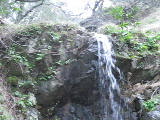
Beauty: 6
Duration: 3 days after a significant rainfall
Height 9 feet
Biggest vertical drop 9 feet
Terrain: woods, little or no trail
Last visited 2019-01-17
id: bigrock.181
- waterfall at (38.053429, -122.555512):
taken 2019-01-17:

Video:

Beauty: 5.5
Duration: 3 days after a significant rainfall
Height 15 feet
Biggest vertical drop 5 feet
Terrain: woods, little or no trail
Last visited 2019-01-17
id: bigrock.182
Unnamed creek flowing southeast
- waterfall at (38.052230, -122.555055):
taken 2019-02-04:


Video:
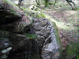
Beauty: 4
Duration: 1 days after a significant rainfall
Height 8 feet
Biggest vertical drop 8 feet
Terrain: woods, little or no trail
Last visited 2019-02-04
id: bigrock.183
- waterfall at (38.052415, -122.554958):
taken 2019-01-17:

Video:
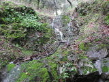
Beauty: 4
Duration: 1 days after a significant rainfall
Height 12 feet
Biggest vertical drop 2 feet
Terrain: woods, little or no trail
Last visited 2019-02-04
id: bigrock.184
back to main waterfalls page


