Waterfalls around Barbier Park / San Pedro Mountain
The San Pedro Mountain area in San Rafael - Barbier Park, San Pedro Mountain Open Space Preserve, China Camp State Park, etc
Barbier Park
Unnamed creek almost north of the east end of Locust Drive
- waterfall at (37.98485, -122.50579):
taken 2010-12-26:
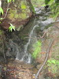
Beauty: 4
Beauty: 3 (including beauty of the hike to the falls)
Duration: 7 days after a significant rainfall
Height 9 feet (broadly defined)
Height 7 feet
Biggest vertical drop 2 feet
Terrain: woods, little or no trail
route: Follow the creek up from the lower part of Gold Hill Grade
Last visited 2010-12-26
id: barbier.1
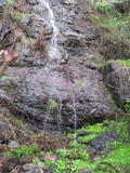
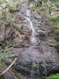
- waterfall at (37.98549, -122.50551):
taken 2010-12-26:
view from the top:
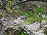
Beauty: 5
Beauty: 4 (including beauty of the hike to the falls)
Duration: 7 days after a significant rainfall
Height 20 feet
Biggest vertical drop 3 feet
Terrain: woods, little or no trail
route: Follow the creek up from the lower part of Gold Hill Grade
Last visited 2010-12-26
id: barbier.2
- This waterfall has an 8+ foot long cave under the bottom drop (I couldn't see the end of the cave) at (37.98639, -122.50528):
taken 2010-12-26:
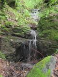
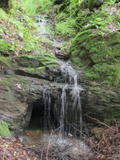
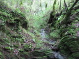
upper drop:
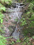
It's near the third palm tree you pass as you follow the creek up from Gold Hill Grade.
There's a 26 foot waterslide at the previous palm, which doesn't quite fit my definition of a waterfall.
Beauty: 6
Beauty: 4 (including beauty of the hike to the falls)
Duration: 7 days after a significant rainfall
Height 15 feet
Biggest vertical drop 4 feet
Number of drops 3
Terrain: woods, little or no trail
route: Follow the creek up from the lower part of Gold Hill Grade
Last visited 2010-12-26
id: barbier.3
Unnamed creek main (northeast) branch of the creek that follows Locust Drive
- waterfall at (37.98432, -122.50339):
Poor gps reception - coordinates may be unreliable
taken 2010-12-26:
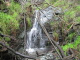
Beauty: 4
Beauty: 3 (including beauty of the hike to the falls)
Duration: 10 days after a significant rainfall
Height 7 feet (broadly defined)
Height 6 feet
Biggest vertical drop 2 feet
Terrain: woods, little or no trail
route: Follow the creek down from an unmarked trail between the upper part of Gold Hill Grade and Bay Hills Fire Rd
Last visited 2010-12-26
id: barbier.4
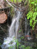
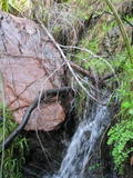
- waterfall at (37.98431, -122.50331):
the lower half taken 2010-12-26:
upper half, hiding under a palm:
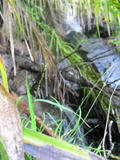
Beauty: 3
Duration: 10 days after a significant rainfall
Height 13 feet (broadly defined)
Height 10 feet
Biggest vertical drop 4 feet
Number of drops 3
Terrain: woods, little or no trail
route: Follow the creek down from an unmarked trail between the upper part of Gold Hill Grade and Bay Hills Fire Rd
Last visited 2010-12-26
id: barbier.5
- waterfall at (37.98512, -122.50272):
taken 2010-12-26:
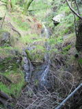
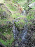
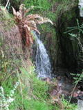
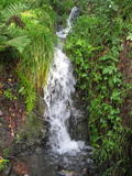
There's a faint trail at the top which might be a slightly easier route to this (I haven't tried it)
Beauty: 4
Beauty: 5 (including beauty of the hike to the falls)
Duration: 10 days after a significant rainfall
Height 28 feet (broadly defined)
Height 9 feet
Biggest vertical drop 4 feet
Number of drops 4
Terrain: woods, little or no trail
route: Follow the creek down from an unmarked trail between the upper part of Gold Hill Grade and Bay Hills Fire Rd
Last visited 2010-12-26
id: barbier.6
- waterfall at (37.98540, -122.50241):
taken 2010-12-26:
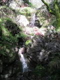
the lower drop:
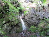
the main drop:
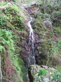
Beauty: 6
Beauty: 5 (including beauty of the hike to the falls)
Duration: 10 days after a significant rainfall
Height 31 feet
Biggest vertical drop 9 feet
Number of drops 2
Terrain: woods, little or no trail
route: Follow the creek down from an unmarked trail between the upper part of Gold Hill Grade and Bay Hills Fire Rd
Last visited 2010-12-26
id: barbier.7
- waterfall at (37.98536, -122.50257):
taken 2010-12-26:
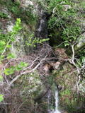

Beauty: 3
Duration: 10 days after a significant rainfall
Height 15 feet (broadly defined)
Height 13 feet
Biggest vertical drop 3 feet
Number of drops 2
Terrain: woods, little or no trail
route: Follow the creek down from an unmarked trail between the upper part of Gold Hill Grade and Bay Hills Fire Rd
Last visited 2010-12-26
id: barbier.8
- waterfall at (37.98579, -122.50250):
taken 2010-12-26:
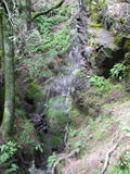
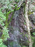
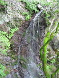
looking down at upper part:
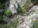
It's not very photogenic.
The top is relatively easy to reach, at the end of a nice meadow, but the scramble down to get a decent view is fairly steep.
Beauty: 8
Duration: 10 days after a significant rainfall
Height 34 feet (broadly defined)
Height 25 feet
Biggest vertical drop 20 feet
Number of drops 3
Terrain: fields, no trail
route: Follow the creek down from an unmarked trail between the upper part of Gold Hill Grade and Bay Hills Fire Rd
Last visited 2010-12-26
id: barbier.9
Unnamed creek north/northwest of the Locust Drive trailhead
- waterfall at (37.98440, -122.50858):
taken 2010-12-26:
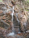
Beauty: 4
Beauty: 5 (including beauty of the hike to the falls)
Duration: 4 days after a significant rainfall
Height 25 feet (broadly defined)
Height 10 feet
Biggest vertical drop 5 feet
Number of drops 3
Terrain: woods, little or no trail
route: just below Gold Hill Grade; easier to reach from the west side of the stream
Last visited 2010-12-26
id: barbier.10
Black Canyon Creek
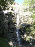
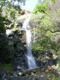
- waterfall at (37.99312, -122.50791):
Name: Mountain View Falls
view from below - upper parts hard to see due to lighting taken 2011-03-01:
 taken 2010-02-28:
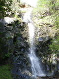
upper part of the main drop, with what I'm calling the 2nd drop on the left taken 2011-03-01:

the 2nd drop:
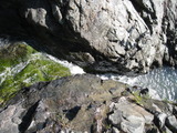
looking down from the top of the 3rd drop:
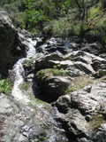
the 4th drop:
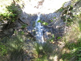
looking up from the 5th drop:
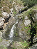
the 6th and 7th drops:
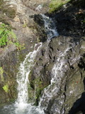
a little farther up; I'm not including these as part of the falls:
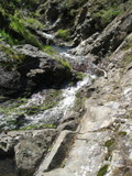
view from 250 yards west on the J T Howell trail; there's a person in the center standing about 20 feet above the top of the main drop; the uppermost 2 drops are visible toward the upper left:
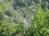
The main drop, which is visible from the bottom, is at least 70 feet. There are more drops above totalling 35 to 50 feet. I'm inclined to count 6 of those upper drops as part of the falls. Parts of the falls can be seen from the road.
Beauty: 9
Beauty: 8 (including beauty of the hike to the falls)
Duration: 20 days after a significant rainfall
Height 110 feet (broadly defined)
Height 70 feet
Biggest vertical drop 20 feet
Number of drops 7
Terrain: unofficial trail, frequently used
route: Drive to the north end of Mountain View Ave. A bit to the right of the road's end, there is a short path (not obviously public, but if you start up it will become clear that it's heavily used. A crude trail follows the creek up from the base of the falls to the J T Howell trail.
Last visited 2011-03-01
id: barbier.11
- waterfall at (37.99530, -122.50370):
taken 2011-03-01:
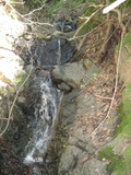
Beauty: 2
Duration: 14 days after a significant rainfall
Height 6 feet
Biggest vertical drop 3 feet
Number of drops 2
Terrain: woods, little or no trail
Last visited 2011-03-01
id: barbier.12
Unnamed creek flowing from near the north tip of Barbier Park south to meet the main creek just below an elevation of 600 feet
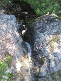
- waterfall at (37.99590, -122.50501):
taken 2011-03-01:
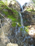

view from top:
Beauty: 5
Duration: 7 days after a significant rainfall
Height 21 feet (broadly defined)
Height 15 feet
Biggest vertical drop 1 feet
Terrain: woods, little or no trail
Last visited 2011-03-01
id: barbier.13
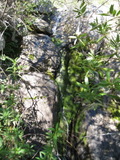
- waterfall at (37.99593, -122.50496):
taken 2011-03-01:
Beauty: 4.5
Duration: 7 days after a significant rainfall
Height 11 feet
Biggest vertical drop 2 feet
Number of drops 2
Terrain: moderate brush, little or no trail
Last visited 2011-03-01
id: barbier.14
Unnamed creek flowing south, meeting Black Canyon Creek 0.1 mile upstream from Mountain View Falls
- waterfall at (37.9939, -122.5068):
gps coordinates estimated from map, reliability unknown
taken 2011-03-01:
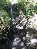
Beauty: 3
Duration: 7 days after a significant rainfall
Height 6 feet
Biggest vertical drop 3 feet
Terrain: woods, little or no trail
Last visited 2011-03-01
id: barbier.15
- waterfall at (37.99455, -122.50688):
taken 2011-03-01:
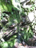
just below a trail
Beauty: 3
Duration: 4 days after a significant rainfall
Height 6 feet
Biggest vertical drop 2 feet
Number of drops 1
Terrain: unofficial trail, frequently used
Last visited 2011-03-01
id: barbier.16
Unnamed creek creek reaching the north end of Mountain View Ave from the northwest
- waterfall at (37.99279, -122.51063):
taken 2010-02-28:
 taken 2011-03-01:
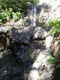
Beauty: 4
Duration: 4 days after a significant rainfall
Height 22 feet (broadly defined)
Height 14 feet
Biggest vertical drop 3 feet
Terrain: unofficial trail, frequently used
Last visited 2011-03-01
id: barbier.21
Unnamed creek small side stream flowing southeast from near the top of the Woodoaks trail
- waterfall at (37.99566, -122.51061):
taken 2011-03-01:
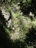
Beauty: 3
Duration: 4 days after a significant rainfall
Height 14 feet (broadly defined)
Height 12 feet
Biggest vertical drop 2 feet
Number of drops 2
Terrain: woods, little or no trail
Last visited 2011-03-01
id: barbier.17
- waterfall at (37.99602, -122.51089):
taken 2011-03-01:
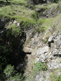
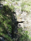
Beauty: 3.5
Duration: 4 days after a significant rainfall
Height 12 feet (broadly defined)
Height 6 feet
Biggest vertical drop 2 feet
Terrain: woods, little or no trail
Last visited 2011-03-01
id: barbier.18
- waterfall at (37.99622, -122.51100):
taken 2011-03-01:
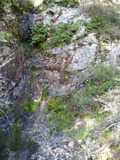
Beauty: 3.5
Duration: 4 days after a significant rainfall
Height 10 feet (broadly defined)
Height 8 feet
Biggest vertical drop 2 feet
Number of drops 1
Terrain: woods, little or no trail
Last visited 2011-03-01
id: barbier.19
- waterfall at (37.99625, -122.51114):
gps coordinates estimated from map, reliability unknown
taken 2011-03-01:
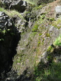
Beauty: 3
Duration: 4 days after a significant rainfall
Height 6 feet
Biggest vertical drop 1 feet
Number of drops 1
Terrain: woods, little or no trail
Last visited 2011-03-01
id: barbier.20
Unnamed creek creek flowing southeast toward Oakdale Ave
- waterfall at (37.99076, -122.51477):
taken 2011-02-17:


Beauty: 5
Duration: 4 days after a significant rainfall
Height 22 feet (broadly defined)
Height 20 feet
Biggest vertical drop 2 feet
Number of drops 3
Terrain: woods, little or no trail
Last visited 2011-02-17
id: barbier.27
- waterfall at (37.99142, -122.51499):
taken 2011-02-17:
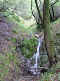
Beauty: 4
Duration: 4 days after a significant rainfall
Height 18 feet (broadly defined)
Height 6 feet
Number of drops 3
Terrain: woods, little or no trail
Last visited 2011-02-17
id: barbier.28
Unnamed creek creek flowing southeast toward Convent Ct
- waterfall at (37.98936, -122.51541):
taken 2011-02-17:
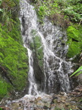
Beauty: 5
Duration: 4 days after a significant rainfall
Height 10 feet
Biggest vertical drop 2 feet
Terrain: woods, little or no trail
route: near a palm tree
Last visited 2011-02-17
id: barbier.25
- waterfall at (37.99018, -122.51557):
taken 2011-02-17:
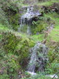
Beauty: 5
Duration: 4 days after a significant rainfall
Height 19 feet (broadly defined)
Height 10 feet
Biggest vertical drop 3 feet
Number of drops 2
Terrain: woods, little or no trail
route: below the J T Howell trail
Last visited 2011-02-17
id: barbier.26
Unnamed creek creek flowing east toward Convent Ct
- waterfall at (37.98902, -122.51694):
taken 2011-02-17:
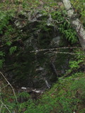
Beauty: 4
Duration: 2 days after a significant rainfall
Height 10 feet
Biggest vertical drop 1 feet
Terrain: woods, little or no trail
Last visited 2011-02-17
id: barbier.24
Unnamed creek creek flowing south toward Glen Park Ave
- waterfall at (37.99009, -122.52178):
taken 2011-02-17:
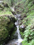
Beauty: 4
Duration: 3 days after a significant rainfall
Height 8 feet (broadly defined)
Height 4 feet
Biggest vertical drop 2 feet
Terrain: woods, little or no trail
route: just upstream from an unnamed trail
Last visited 2011-02-17
id: barbier.22
- waterfall at (37.98900, -122.52225):
taken 2011-02-17:
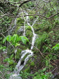
Beauty: 4
Duration: 3 days after a significant rainfall
Height 10 feet (broadly defined)
Height 6 feet
Biggest vertical drop 2 feet
Terrain: woods, little or no trail
Last visited 2011-02-17
id: barbier.23
Glenwood Creek
- waterfall at (37.992249, -122.498390):
taken 2019-02-27:

Video:
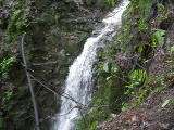
Beauty: 3.5
Duration: 5 days after a significant rainfall
Height 8 feet
Biggest vertical drop 6 feet
Terrain: woods, little or no trail
Last visited 2019-02-27
id: barbier.29
Unnamed creek flowing southeast into the upper part of Glenwood Creek
- waterfall at (37.992424, -122.498366):
taken 2019-02-27:

Video:
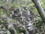
Beauty: 4
Duration: 1 days after a significant rainfall
Height 8 feet
Biggest vertical drop 5 feet
Terrain: woods, little or no trail
Last visited 2019-02-27
id: barbier.39
- waterfall at (37.992638, -122.498272):
taken 2019-02-27:

Video:

Beauty: 4
Duration: 1 days after a significant rainfall
Height 10 feet
Biggest vertical drop 3 feet
Terrain: woods, little or no trail
Last visited 2019-02-27
id: barbier.40
Unnamed creek flowing southeast into the upper part of Glenwood Creek
- waterfall at (37.993868, -122.497646):
taken 2019-02-27:

Video:

Beauty: 5.5
Duration: 4 days after a significant rainfall
Height 29 feet
Biggest vertical drop 5 feet
Terrain: woods, little or no trail
Last visited 2019-02-27
id: barbier.41
- waterfall at (37.993990, -122.498130):
taken 2019-02-27:

Video:
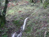
Beauty: 5
Duration: 3 days after a significant rainfall
Height 25 feet
Biggest vertical drop 3 feet
Terrain: woods, little or no trail
Last visited 2019-02-27
id: barbier.42
San Pedro Mountain Open Space Preserve
Unnamed creek just south of the Woodoaks trail
- waterfall at (38.000936, -122.518345):
taken 2017-02-16:

Video:

Beauty: 5.5
Duration: 3 days after a significant rainfall
Height 32 feet
Terrain: woods, little or no trail
Last visited 2017-02-16
id: barbier.34
Unnamed creek
- waterfall at (38.003658, -122.509375):
taken 2017-02-16:

Video:
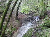
Beauty: 5.5
Duration: 6 days after a significant rainfall
Height 14 feet
Biggest vertical drop 2 feet
Terrain: woods, little or no trail
unclear whether this is on public or private land
Last visited 2017-02-16
id: barbier.33
Unnamed creek
- waterfall at (38.003733, -122.509387):
taken 2017-02-16:

Video:
Beauty: 4
Duration: 2 days after a significant rainfall
Height 14 feet (broadly defined)
Height 8 feet
Biggest vertical drop 6 feet
Terrain: woods, little or no trail
unclear whether this is on public or private land
Last visited 2017-02-16
id: barbier.32
China Camp State Park
Glenwood Creek
- waterfall at (37.99205, -122.49512):
taken 2019-02-27:


Video:
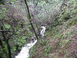
There are lots of places on this and neighboring creeks that seem borderline as to whether I should classify them as a waterfall
Beauty: 4
Duration: 14 days after a significant rainfall
Height 14 feet
Biggest vertical drop 1 feet
Terrain: vague hints of a trail
Last visited 2019-02-27
id: barbier.30
- waterfall at (37.99184, -122.49457):
Video:

Beauty: 4
Duration: 14 days after a significant rainfall
Height 10 feet
Biggest vertical drop 3 feet
Terrain: vague hints of a trail
Last visited 2019-02-27
id: barbier.31
Unnamed creek flowing southeast
- waterfall at (37.994299, -122.494022):
taken 2019-02-27:

Beauty: 4
Duration: 3 days after a significant rainfall
Height 7 feet
Biggest vertical drop 5 feet
Terrain: vague hints of a trail
Last visited 2019-02-27
id: barbier.45
Unnamed creek flowing south from the top of Back Ranch Fire Road
- waterfall at (37.995318, -122.493654):
taken 2019-02-27:

Beauty: 3.5
Duration: 4 days after a significant rainfall
Height 6 feet
Biggest vertical drop 3 feet
Terrain: vague hints of a trail
Last visited 2019-02-27
id: barbier.44
Unnamed creek from Bayview trail just north of Echo trail junction, flowing east-northeast
- waterfall at (38.001365, -122.498355):
taken 2018-04-07:

Video:
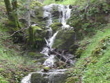
Beauty: 5.5
Duration: 4 days after a significant rainfall
Height 10 feet
Biggest vertical drop 2 feet
Terrain: woods, little or no trail
Last visited 2018-04-07
id: barbier.35
Unnamed creek flowing north from the Nike missile site, turning east to Back Ranch campground
- waterfall at (38.001862, -122.501665):
taken 2018-04-07:


Video:
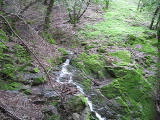
Beauty: 7.5
Duration: 5 days after a significant rainfall
Height 25 feet give or take 2 feet
Biggest vertical drop 12 feet
Terrain: unofficial trail, frequently used
route: There's an obvious trail following the creek up from the Shoreline trail
Last visited 2018-04-07
id: barbier.36
- waterfall at (38.000787, -122.502309):
taken 2018-04-07:

Videos:
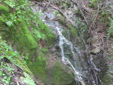
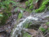
Beauty: 4
Duration: 3 days after a significant rainfall
Height 9 feet
Biggest vertical drop 2 feet
Terrain: well-maintained trail
route: Visible from the Bayview trail
Last visited 2018-04-07
id: barbier.37
Unnamed creek from the Nike missile site to east end of Echo trail
- waterfall at (37.998610, -122.500352):
taken 2018-04-07:

Video:
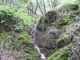
Beauty: 4
Duration: 4 days after a significant rainfall
Height 12 feet
Biggest vertical drop 2 feet
Terrain: vague hints of a trail
Last visited 2018-04-07
id: barbier.38
Unnamed creek near Back Ranch Fire Road
- waterfall at (38.000475, -122.496087):
taken 2019-02-27:

Video:
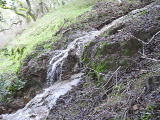
Beauty: 3
Duration: 1 days after a significant rainfall
Height 12 feet
Biggest vertical drop 2 feet
Terrain: well-maintained fire road
Last visited 2019-02-27
id: barbier.43
back to main waterfalls page


 taken 2010-02-28:


 taken 2011-03-01:


