Little known waterfalls around Point Reyes National Seashore
Point Reyes National Seashore
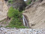
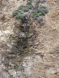
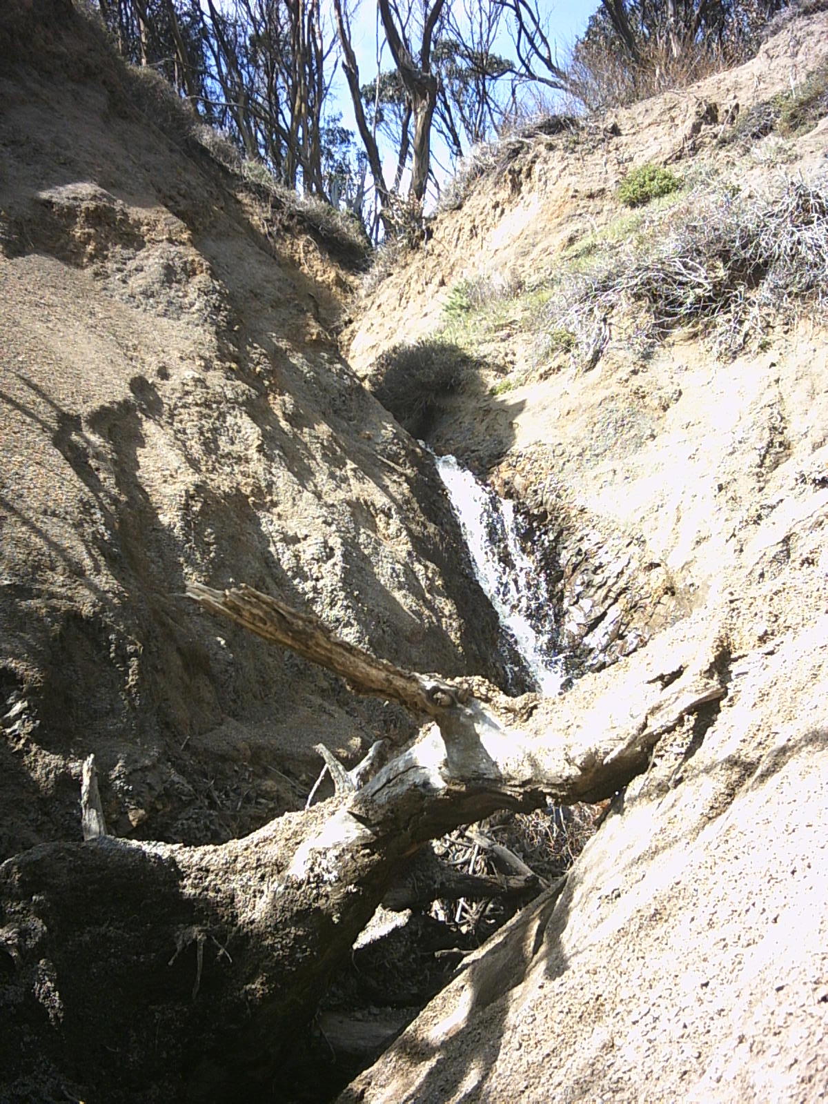
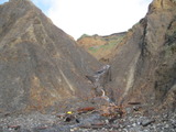
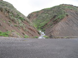
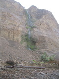
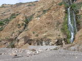
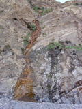
Unnamed creek about 2/3 mile northwest of Agate Beach (Bolinas)
- Waterfall south of Bolinas Point at (37.90197, -122.72048):

Beauty: 3
Beauty: 6 (including beauty of the hike to the falls)
Duration: 14 days after a significant rainfall
Height 10 feet (broadly defined)
Height 8 feet
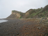
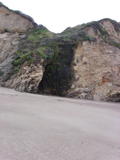
Terrain: beach at low tide
route: Reachable at most low tides via Agate Beach County Park.
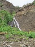
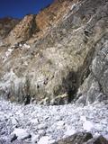
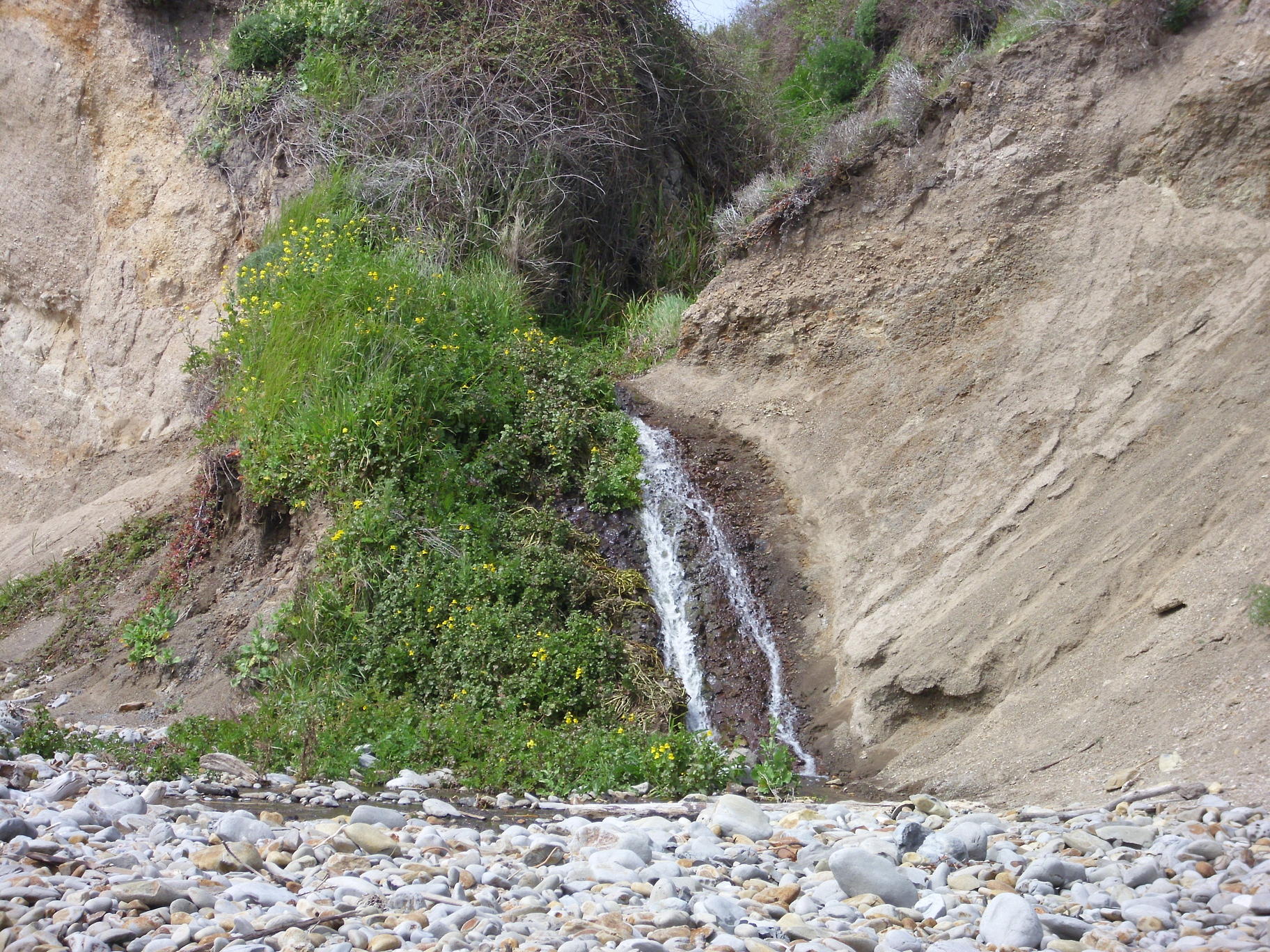
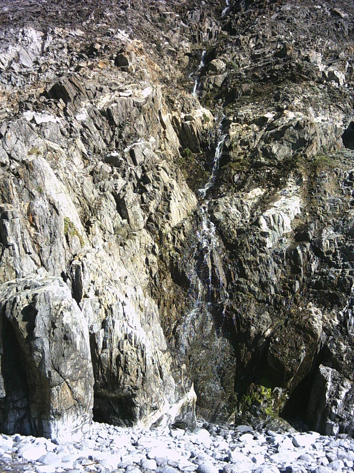
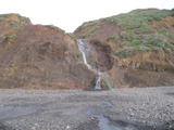
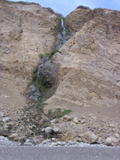
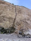
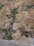
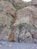
Unnamed creek just north of Bolinas Point
- Waterfall just north of Bolinas Point at (37.90445, -122.72716):

Beauty: 7
Beauty: 8 (including beauty of the hike to the falls)
Duration: 20 days after a significant rainfall
Height 25 feet (broadly defined)
Height 18 feet
Biggest vertical drop 3 feet
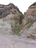
Terrain: beach at low tide
route: Park at 451 Mesa Road, follow a poorly marked trail down to RCA beach, and go south on the beach about 1 mile. Also reachable at most low tides via the Palomarin trailhead, and from Agate Beach County Park at minus tides.
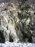
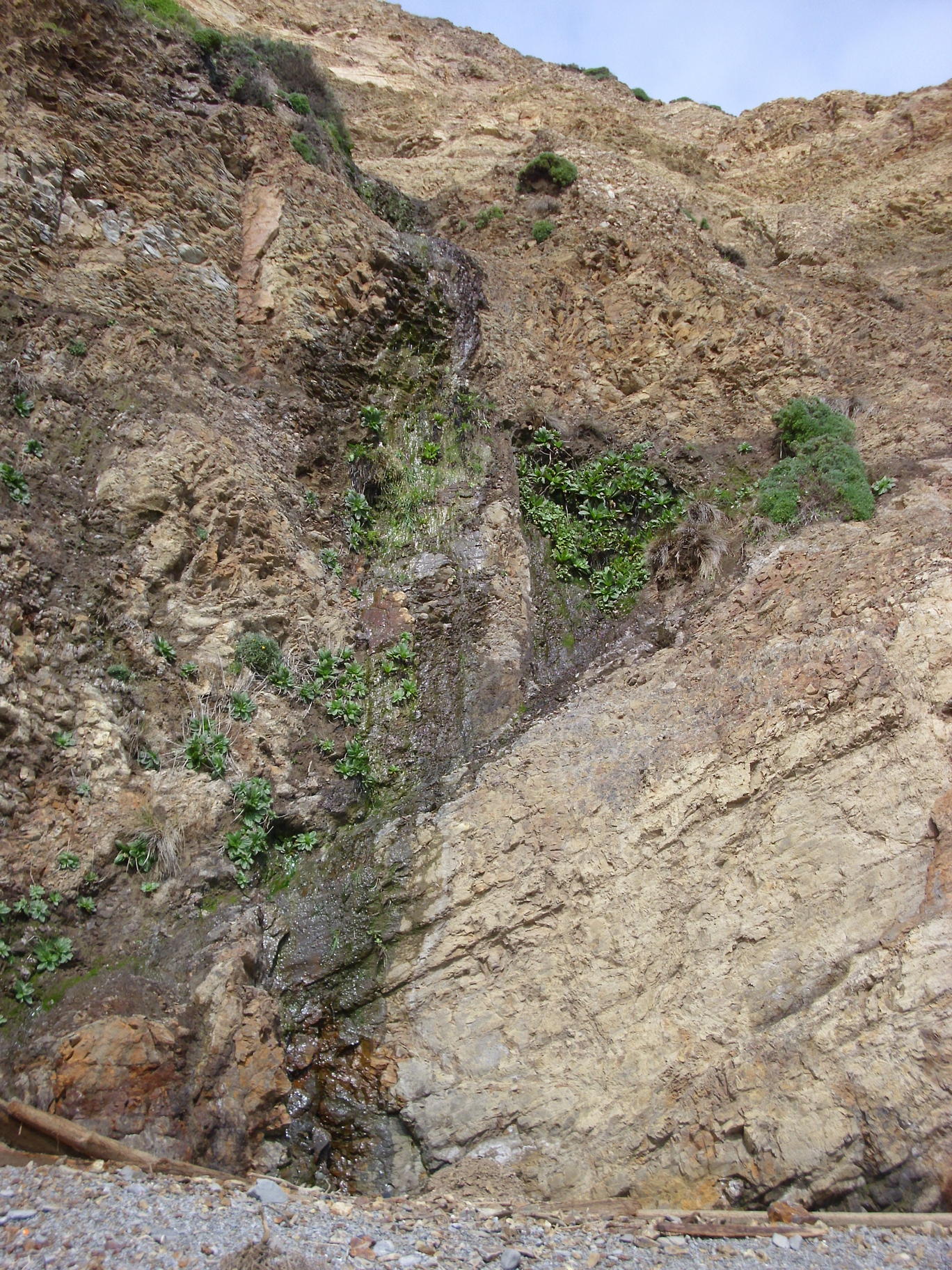
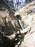
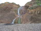
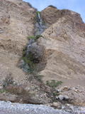
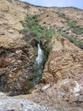
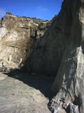
Unnamed creek RCA Beach
- Waterfall at RCA Beach at (37.91636, -122.73085):
There's a large (10+ feet) squarish concrete block partly visible (from a different angle than this picture) just around the corner upstream from the top
Beauty: 2
Beauty: 5 (including beauty of the hike to the falls)
Duration: 30 days after a significant rainfall
Height 16 feet (broadly defined)
Height 10 feet
Biggest vertical drop 2 feet
Number of drops 2
Terrain: beach at low tide
route: Park at 451 Mesa Road, follow a poorly marked trail down to RCA beach, and go north on the beach a short distance. Also reachable at most low tides via the Palomarin trailhead
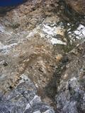
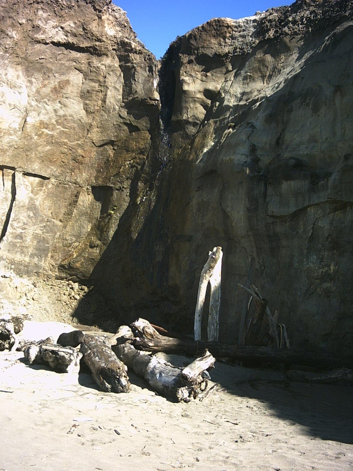
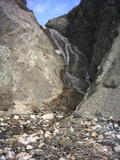
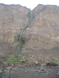
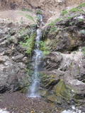
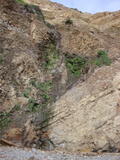
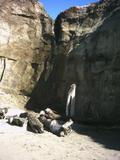
Unnamed creek half mile southeast of Arroyo Honda
- waterfall at (37.92012, -122.73275):
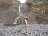
Beauty: 7
Beauty: 8 (including beauty of the hike to the falls)
Duration: 30 days after a significant rainfall
Height 28 feet (broadly defined)
Height 25 feet
Biggest vertical drop 5 feet
Terrain: beach at low tide
route: Park at 451 Mesa Road, follow a poorly marked trail down to RCA beach, and go north on the beach less than half a mile. Also reachable at most low tides via the Palomarin trailhead
Arroyo Honda
- waterfall at (37.92580, -122.73668):


I think I recall walking upstream many years ago and finding a waterfall that couldn't be seen from the beach.
Beauty: 6
Beauty: 7 (including beauty of the hike to the falls)
Duration: 365 days after a significant rainfall
Height 26 feet
Biggest vertical drop 4 feet
Number of drops 5
Terrain: beach at low tide
route: From the Palomarin trailhead, start toward Bass Lake, turn left in the Eucalyptus grove. After winding downhill a half mile to the beach, turn left and walk at least half a mile. The beach is mostly sandy at low tide. It can probably be done near a high tide, but I recommend waiting for the tide to go out a bit.
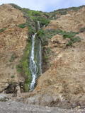
Unnamed creek ending at Palomarin Beach just northwest of the trail
Unnamed creek between Palomarin Beach and Abalone Point
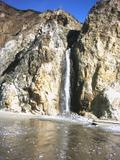
- A 65 foot waterfall a half mile northwest of the Palomarin trailhead at (37.93552, -122.75564):
Nearly vertical except for the top 15+ feet and a ledge 1/3 of the way from the bottom
Beauty: 8
Beauty: 8 (including beauty of the hike to the falls)
Duration: 14 days after a significant rainfall
Height 65 feet
Biggest vertical drop 14 feet
Number of drops 5
Terrain: beach at low tide
route: From the Palomarin trailhead, start toward Bass Lake, turn left in the Eucalyptus grove. After winding downhill a half mile to the beach, turn right and walk about a half mile. The beach will be mostly small rocks which will slow you down. It can probably be done at high tide, but I recommend waiting for the tide to go out a bit.
Unnamed creek between Palomarin Beach and Abalone Point
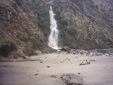
- waterfall at (37.93629, -122.76030):
Beauty: 7
Beauty: 8 (including beauty of the hike to the falls)
Duration: 4 days after a significant rainfall
Height 50 feet (broadly defined)
Height 45 feet
Terrain: beach at low tide
route: From the Palomarin trailhead, start toward Bass Lake, turn left in the Eucalyptus grove. After winding downhill a half mile to the beach, turn right and walk about 0.6 mile. The beach will be mostly small rocks which will slow you down. It can probably be done at high tide, but I recommend waiting for the tide to go out a bit.
Unnamed creek 0.2 miles east of Abalone Point, emerging from cliff below where the Coast Trail turns inland
- waterfall at (37.93666, -122.76143):
Beauty: 7
Beauty: 8 (including beauty of the hike to the falls)
Duration: 60 days after a significant rainfall
Height 22 feet (broadly defined)
Terrain: beach at low tide
route: From the Palomarin trailhead, start toward Bass Lake, turn left in the Eucalyptus grove. After winding downhill a half mile to the beach, turn right and walk about 0.8 mile. The beach will be mostly small rocks which will slow you down. It can probably be done at high tide, but I recommend waiting for the tide to go out a bit.
Unnamed creek coming out of Bass Lake
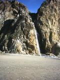
- waterfall at (37.94153, -122.76805):
It's at least 60 feet high (I'm unsure whether I can see the top). The main drop is 22 to 25 feet high.
Beauty: 9
Beauty: 9 (including beauty of the hike to the falls)
Duration: 90 days after a significant rainfall
Height 60 feet
Biggest vertical drop 25 feet
Terrain: beach at low tide
route: The next set of waterfalls can be reached at a minus tide from Palomarin Beach. It's also possible to get the by starting down a faint trail at the intersection of the Coast Trail and the Crystal Lake trail. Near the end of the trail, do some bushwhacking off to the left (expect to touch poison oak), head down a steep and somewhat difficult hill that descends to the southeast point of Double Point, then head for the beach on the left.
Last visited 2010-03-25
Unnamed creek just north of the stream coming out of Bass Lake
- waterfall
Beauty: 6
Beauty: 8 (including beauty of the hike to the falls)
Duration: 60 days after a significant rainfall
Height 25 feet
Terrain: beach at low tide
Last visited 2010-03-25
Unnamed creek a bit north of the stream coming out of Bass Lake
Unnamed creek coming from between Bass Lake and Pelican Lake
- waterfall at (37.94329, -122.76994):

Beauty: 7
Beauty: 8 (including beauty of the hike to the falls)
Duration: 60 days after a significant rainfall
Height 25 feet (broadly defined)
Height 12 feet
Terrain: beach at low tide
Last visited 2010-03-25
- waterfall at (37.94385, -122.77084):
Beauty: 4
Beauty: 6 (including beauty of the hike to the falls)
Duration: 7 days after a significant rainfall
Height 20 feet
Terrain: beach at low tide
Last visited 2010-03-25
Unnamed creek just west of the previous one
- waterfall
Beauty: 3
Beauty: 6 (including beauty of the hike to the falls)
Duration: 7 days after a significant rainfall
Height 25 feet
Terrain: beach at low tide
Last visited 2010-03-25
Unnamed creek descending from Pelican Lake
- waterfall at (37.948, -122.7775):
Name: Pelican Falls
gps coordinates estimated from map, reliability unknown
Only reachable via a rocky beach at minus tides? Elephant Seals mate here in winter and early spring. It's illegal and probably unsafe to visit when they're present, which would be the best time to find a convenient low tide. I plan to visit this someday in November, but November low tides are late enough in the afternoon that I won't return to the trailhead before dark.
Duration: 365 days after a significant rainfall
Height 100 feet
Terrain: beach at low tide
For more info, see Secret Waterfalls of Marin volume 2
Alamere Creek
- waterfall at (37.9537, -122.7834):
Name: Alamere Falls
gps coordinates estimated from map, reliability unknown
Beauty: 10
Beauty: 10 (including beauty of the hike to the falls)
Duration: 365 days after a significant rainfall
Height 50 feet
Number of drops 1
Terrain: official trail, not well maintained
For more info, see California Waterfalls, by Ann Marie Brown
Unnamed creek just north of Kehoe Beach
- waterfall at (38.1582, -122.949415):
gps coordinates estimated from map, reliability unknown
Beauty: 7
Beauty: 8 (including beauty of the hike to the falls)
Duration: 7 days after a significant rainfall
Height 15 feet
Terrain: beach at low tide
route: From Kehoe Beach, walk north a short distance. It is probably reachable at most tides.
Last visited 2007-02-13
Unnamed creek in what Tom Harrison's map calls Chute Gulch
- waterfall at (38.174425, -122.95295):
Name: Ribbon Falls
gps coordinates estimated from map, reliability unknown
There are conflicting reports about whether this flows year round. Given the difficulty of reaching it, nobody should go there in the dry season.
Beauty: 9
Beauty: 10 (including beauty of the hike to the falls)
Duration: 365 days after a significant rainfall
Height 60 feet (broadly defined)
Height 50 feet
Terrain: beach at low tide
For more info, see Secret Waterfalls of Marin volume 2
route: From Kehoe Beach, walk/climb/wade north a mile and a half. Do not attempt this without reading Secret Waterfalls of Marin volume 2.
Last visited 2007-02-13
Unnamed creek just north of Chute Gulch
Unnamed creek just north of Chute Gulch
Unnamed creek near Elephant Rock
- waterfall at (37.99669, -122.82120):
Name: Kelham Beach Cascade

Beauty: 7
Beauty: 8 (including beauty of the hike to the falls)
Duration: 365 days after a significant rainfall
Height 18 feet (broadly defined)
Biggest vertical drop 6 feet
Terrain: well-maintained trail
For more info, see Secret Waterfalls of Marin volume 2
Last visited 2010-12-03
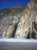
- waterfall at (37.99289, -122.81799):
Name: Surprise Falls
(Surprise Falls from Secret Waterfalls of Marin volume 2?)
Beauty: 7
Beauty: 8 (including beauty of the hike to the falls)
Duration: 30 days after a significant rainfall
Height 30 feet (broadly defined)
Biggest vertical drop 25 feet
Number of drops 1
Terrain: beach
Kelham
For more info, see Secret Waterfalls of Marin volume 2
Last visited 2010-12-03
- waterfall at (37.99475, -122.81918):
Beauty: 5
Beauty: 7 (including beauty of the hike to the falls)
Duration: 20 days after a significant rainfall
Height 12 feet (broadly defined)
Number of drops 1
Terrain: beach
Kelham
Last visited 2010-12-03
- Just north of a promontory that's hard to get around even at very low tides, this looks like it would be a 25 foot waterfall after a heavy rain at (37.99850, -122.82446):

I got there by traversing a near-vertical cliff a few inches above the water at a tide of -1 foot, with nearby buoys reporting 5 foot swells (the waves looked around 2 feet high to me). I could also have waded through water about a foot deep. Unless you're lucky enough to get waves this small, wait for a tide of about -1.5 feet.
Beauty: 7
Beauty: 8 (including beauty of the hike to the falls)
Duration: 2 days after a significant rainfall
Height 25 feet (broadly defined)
Number of drops 1
Terrain: beach at low tide
Kelham
Last visited 2010-12-03