-
Pacheco Creek
- This stands out as by far the most impressive mid or late April hike in the bay area (at least in wet years). At that time the wildflowers are enough reason to hike 80% of the way to the falls, and the other top bay area waterfalls are well past the best time to visit, or can wait until summer. at (37.14143, -121.40796):
Name: Pacheco Falls
upper part taken 2006-04-17: taken 2017-04-22:
lower part:
When taking this photo, I thought I could see a tiny piece of one of the uppermost drops, but I don't see it now:
Videos:
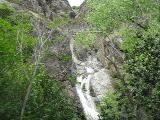
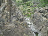
A series of cascades and pools. I've counted two waterslides at the top as part of the falls. I considered excluding them as not vertical enough (in which case the height would be in the 100 to 120 foot range - I didn't measure that well), but decided they blend in well with the others and mark a sudden transition at their top.
The lowest two drops are about 55 feet combined. The others are smaller. It's hard to see much more than half the falls from one spot.
Beauty: 9.5
Beauty: 10 (including beauty of the hike to the falls)
Duration: 60 days after a significant rainfall
Height 135 feet give or take 10 feet
Biggest vertical drop 20 feet
Number of drops 7
Terrain: official trail, not well maintained
route: It's normally reached via a very scenic 20 mile hike (4000 feet elevation gain) from the Coyote Creek trailhead. The simplest (but not best) route follows Coit Road to the ridge after Coit Lake, turns right, then takes the next left and stays right after that. There are shorter and more scenic routes that start up Grizzly Gulch. I recommend passing Coit Lake in one direction and Tule Pond in the other direction, to see the best flowers. After seeing the bottom of the falls, be sure to look for a side trail about 150 feet higher that traverses to a view of the upper part. Last time I was there it was marked by a cairn, but was otherwise hard to notice. When heading up, look for it on the right where the main trail turns left.
The falls can also be reached from the Dowdy Ranch entrance (not open very often) with a 17 mile hike with 3400 feet of elevation gain. During the annual back country weekend, (maybe hard to get a permit) you can drive to County Line Road and reach the falls via an 11 mile hike with 3200 feet of elevation gain.
Last visited 2017-04-22
id: coe.1 - waterfall at (37.130648, -121.377273):
Name: Hole in the Rock
taken 2016-05-08:


Videos:
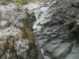
The swimming hole at the bottom should be quite good in late May. It may dry up by early summer.
Beauty: 8
Duration: 60 days after a significant rainfall
Height 13 feet give or take 1 feet
Biggest vertical drop 3 feet
Number of drops 3
Terrain: easy streambed
route: At low flows, it's easy to follow the creek upstream from Kaiser Aetna Rd. Beware that the Dowdy Ranch entrance is only open on dry weekends.
Last visited 2016-05-08
id: coe.15 - waterfall in Grizzly Gulch at (37.10606, -121.45529):
taken 2010-04-11: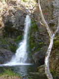
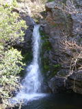 taken 2022-01-08:
Video: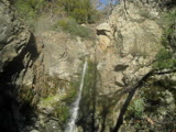
I see a report of another waterfall nearby. I have verified that it is not downstream (It is not too hard to follow the creek down to the trail crossing if the water is not too high. I did it when the flow on this gage was around 20 cfs). I am guessing that the upper waterfall is a half mile upstream, and probably best reached by going a half mile farther up the Grizzly Gulch trail and descending.
Beauty: 8
Beauty: 9 (including beauty of the hike to the falls)
Duration: 30 days after a significant rainfall
Height 17 feet
Biggest vertical drop 10 feet
Number of drops 1
Terrain: vague hints of a trail
route: The shortest route from an official trail starts from a small ridge on the Grizzly Gulch trail about halfway between the Cullen trail and the Tower trail. There's something vaguely resembling a path that goes southeast from there, crossing the bottom of the gully and descending steeply through bushes and poison oak (not too thick) on the northeast side of the gully.
Last visited 2022-01-08
id: coe.2 - waterfall at (37.099672, -121.422331):
taken 2017-04-22:
Video: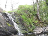
Rather artificial, created by the Tule Pond dam. I include it anyway because it's a good excuse to remember that this is a great place to visit due to wildflowers.
Beauty: 4.5
Beauty: 9.5 (including beauty of the hike to the falls)
Duration: 20 days after a significant rainfall
Height 7 feet
Biggest vertical drop 1 feet
Terrain: vague hints of a trail
Last visited 2017-04-22
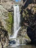
id: coe.17 - An impressive waterfall, the 2nd best in Henry Coe. Alas, it is hard enough to reach that I expect I will not visit it again. at (37.106712, -121.451036):
Name: Upper Grizzly Gulch Falls
taken 2024-02-10: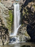
Video: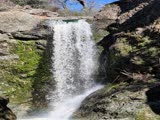
I visited it when the flow on this gage was around 200 cfs. I needed to do 2 creek crossings just before reaching a view of the waterfall. I got my feet slightly wet. The crossings would be fairly hard if the flow were much higher.
Beauty: 9
Duration: 30 days after a significant rainfall
Height 34 feet
Biggest vertical drop 30 feet
Number of drops 1
Terrain: dense bushes
route: See my gpx track. The basic idea is to follow a small creek down to the main creek, staying on the west side most of the way, and crossing to the east side of the side creek near the steep bushy final 100 yards to main creek. Then head up along the main creek. Expect to touch a good deal of poison oak.
route: download gpx
Last visited 2024-02-10
id: coe.24 - waterfall at (37.18189, -121.51061):
taken 2017-04-08:

Videos: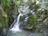
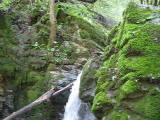
It's about 1/3 mile upstream from the lower end of the Middle Ridge Trail.
Beauty: 6
Duration: 45 days after a significant rainfall
Height 10 feet (broadly defined)
Height 8 feet
Biggest vertical drop 6 feet
Terrain: streambed with some difficulties
route: Go to the part of Poverty Flat Road where it descends below an elevation of 1600 feet. Head directly downhill near the small gully. It will be fairly easy terrain until you get 100 feet above the creek. At that point your choices are 1) head downstream a few hundred yard (staying above a cliff), then descend (through poison oak) into the creek and wade upstream; 2) descend in the middle of a not-too-recent mudslide (which seemed just barely safe when I was there); or 3) head upstream (probably easier, I haven't tried it, but it should get you a view from the top of the falls).
Last visited 2017-04-08
id: coe.3 - waterfall at (37.19628, -121.53233):
taken 2010-06-19: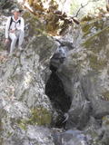
I'll need to return someday when it has more than a trickle.
Beauty: 4
Duration: 45 days after a significant rainfall
Height 8 feet
Biggest vertical drop 8 feet
Terrain: streambed with some rock climbing
route: about 1/4 mile downstream from the Fish Trail
Last visited 2010-06-19
id: coe.4 - waterfall at (37.103248, -121.428425):
taken 2023-03-05:
upper half:
Video: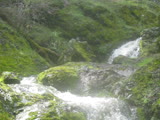
Beauty: 6.5
Duration: 10 days after a significant rainfall
Height 10 feet
Biggest vertical drop 2 feet
Number of drops 2
Terrain: moderate brush, little or no trail
Last visited 2023-03-05
id: coe.18 - waterfall at (37.104351, -121.428040):
taken 2023-03-05:
Beauty: 5.5
Duration: 7 days after a significant rainfall
Height 5 feet
Biggest vertical drop 3 feet
Terrain: moderate brush, little or no trail
Last visited 2023-03-05
id: coe.19 - waterfall at (37.107579, -121.443417):
taken 2023-03-05:
Video: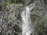
Beauty: 5
Duration: 5 days after a significant rainfall
Height 10 feet
Biggest vertical drop 10 feet
Terrain: moderate brush, little or no trail
Last visited 2023-03-05
id: coe.20 - waterfall at (37.106451, -121.461262):
taken 2023-03-05:
Video: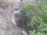
just below the Cullen trail
Beauty: 5
Duration: 7 days after a significant rainfall
Height 8 feet
Biggest vertical drop 8 feet
Terrain: well-maintained trail
Last visited 2023-03-05
id: coe.21 - waterfall at (37.12289, -121.42928):
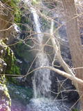
Just downstream from Kelly Lake (presumably formed when the Kelly Lake dam diverted the stream). It's hard to see because it faces into bushes.
Beauty: 3
Beauty: 6 (including beauty of the hike to the falls)
Duration: 30 days after a significant rainfall
Height 12 feet (broadly defined)
Height 10 feet
Biggest vertical drop 5 feet
Terrain: official trail, not well maintained
Last visited 2010-03-28
id: coe.5 - about 100 feet upstream from Bear Springs at (37.21946, -121.43511):
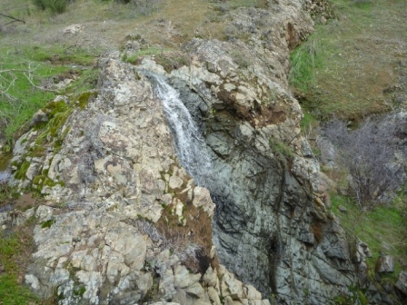
(picture by someone crazy enough to get there in January).
It was dry when I saw it. It will be hard to visit when it's actually running. You can get there by a 15 mile hike on a backcountry weekend, when it might be running in a wetter than average spring. Or you can do it as a 24 mile hike from the main entrance, but when the waterfall is running nicely that will involve some unpleasant stream crossings.
Beauty: 5
Beauty: 7 (including beauty of the hike to the falls)
Duration: 16 days after a significant rainfall
Height 10 feet
Biggest vertical drop 8 feet
Terrain: official trail, not well maintained
id: coe.6 - waterfall at (37.08036, -121.44040):
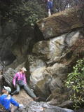
It would be hard to get a good view when flowing (if I try, I'll only hope for a top-down view), as it's facing into a narrow slot; you'd probably need to wade into 2-foot deep water and get nearly underneath the falls to get a full view. There's a second waterfall a short ways above it, about 6 feet high.
Beauty: 4
Height 10 feet
Terrain: streambed with some rock climbing
Last visited 2010-10-17
id: coe.7 - The third waterfall at (37.08295, -121.43939):
It's hard to photograph because I could only see it close up, just after following the creekbed through a small cave-like passage.
Beauty: 4
Height 10 feet
Terrain: streambed with some rock climbing
Last visited 2010-10-17
id: coe.8 - The fourth waterfall at (37.08339, -121.43842):
Beauty: 3
Height 6 feet
Terrain: streambed with some rock climbing
Last visited 2010-10-17
id: coe.9 - the last waterfall that we saw; hard enough to climb that some of us left the creek (going up the east bank) rather than climb it at (37.08412, -121.43813):
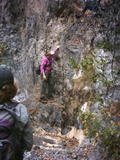
Beauty: 4
Height 8 feet
Biggest vertical drop 8 feet
Terrain: moderate brush, little or no trail
route: It should be relatively easy to get near it by going downhill from the Bowl Trail halfway between Middle Steer Ridge and Lyman Willson Ridge. The only steep part would be descending the last 100 feet to reach the creek.
Last visited 2010-10-17
id: coe.11 - waterfall at (37.08376, -121.43818):
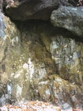
Beauty: 4
Height 7 feet
Biggest vertical drop 7 feet
Terrain: streambed with some rock climbing
id: coe.10 - waterfall at (37.20621, -121.52112):
taken 2011-04-16: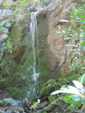
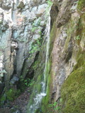
There appeared to be one or more upper drops that I didn't get a good view of. It takes a lot of effort to reach this, and I don't think it's worth the effort.
Beauty: 6
Duration: 25 days after a significant rainfall
Height 20 feet (broadly defined)
Height 10 feet
Biggest vertical drop 10 feet
Terrain: steep slopes with rock outcroppings
route: From the summit of Mt. Sizer, follow one of the streams flowing south.
Last visited 2011-04-16
id: coe.12 - waterfall at (37.20457, -121.52299):
taken 2011-04-16: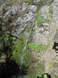
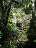
It takes a lot of effort to reach this, and I don't think it's worth the effort.
Beauty: 4.5
Duration: 25 days after a significant rainfall
Height 11 feet (broadly defined)
Height 9 feet
Biggest vertical drop 5 feet
Number of drops 1
Terrain: woods, little or no trail
route: From the summit of Mt. Sizer, follow one of the streams flowing south. Or it might be easier to follow the Middle Fork creekbed upstream from Poverty Flat.
Last visited 2011-04-16
id: coe.13 - waterfall at (37.29506, -121.40529):
Name: Pinto Creek Falls
taken 2003-02-01: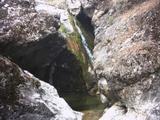
also called Barry's Bathtub; I am just guessing on the height based on my old photo
Beauty: 6
Duration: 30 days after a significant rainfall
Height 12 feet
Terrain: well-maintained trail
Last visited 2003-02-01
id: coe.22 - waterfall at (37.28208, -121.36202):
Name: Robison Creek Falls
I have not visited this; my info is from https://coepark.net/map/water.php; see also photo at https://alpharoaming.files.wordpress.com/2014/05/2009_04_17_coe_chriskangas.jpg
Beauty: 6.5
Duration: 50 days after a significant rainfall
Height 10 feet
Terrain: moderate brush, little or no trail
For more info, see:
https://alpharoaming.com/2014/05/12/orestimba/
id: coe.23 - waterfall at (37.143714, -121.355517):
taken 2016-05-08:
This looks like it would be quite impressive at high flows, but it's hard to get to when it has much water.
Beauty: 8
Duration: 20 days after a significant rainfall
Height 27 feet give or take 2 feet
Biggest vertical drop 5 feet
Terrain: steep slopes with moderate brush
route: It's about 4 miles from Dowdy Ranch, but the road to Dowdy Ranch is only open for the public to drive when the road is quite dry. So after a heavy rain, the way to get there is to hike or bike from Bell Station (an additional 7 miles).
In dry conditions it's fairly easy to follow the creek down to where the top of the waterfall is visible (if I go back at high flows, I'll probably stay on the north side of the creek). It's somewhat hard to go the next hundred yards to see the waterfall from downstream - it requires going a least 100 feet up a steep bank on either side (the south side has a shorter route, but more poison oak).
Last visited 2016-05-08
id: coe.14
gps coordinates estimated from map, reliability unknown
taken 2017-04-08:

Video:
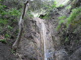
Beauty: 5.5
Duration: 0.5 days after a significant rainfall
Height 18 feet
Biggest vertical drop 18 feet
Terrain: road
route: On the right just after the bridge over the southern tip of Anderson Lake.
Last visited 2017-04-08
id: coe.16